Leaving the giant state of Texas was a bit overwhelming. We had barely scratched the surface on this giant state, and we were sadly moving on. We drove through El Paso in exactly the same way we had bypassed Houston with its multi lane highway and overpasses galore. The historic markers allude to the old times when this was New Spain and the route between Mexico City and Santa Fe. Flat long highways that were lined with acres and acres of pecan and pistachio groves.
Shacks along the way advertised their availability. We stopped at the at the Don José bakery just outside of Big Bend Ranch State Park at Presidio on our way north to the I-10. It was the first of a few Mexican bakeries that we visited. Not a word of English was spoken but a few of the patrons were able to translate to the Mexican baker and his wife what we were looking for. We were looking for anything fresh and tasty and these clients had us buy their favourites; the rolls that were like brioche with anise seeds in it. OMG. These were fresh, still warm, and we could have eaten 6 of them in one go. The other buns we bought were a simple oblong white roll that were a bit of a staple. We found a plastic tub of rustic (homemade) pork stew in a cooler and bought fresh tortillas from them to have with it. Delish! We really just wanted a loaf of bread. Usually I bake bread but… this was way better.
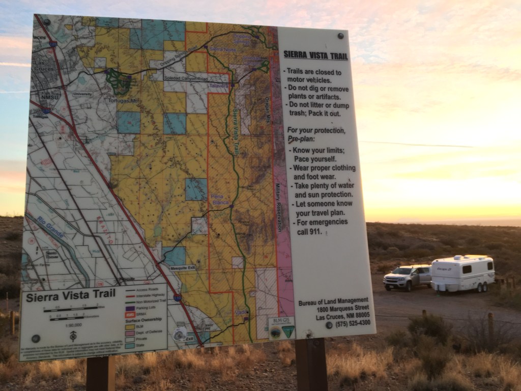
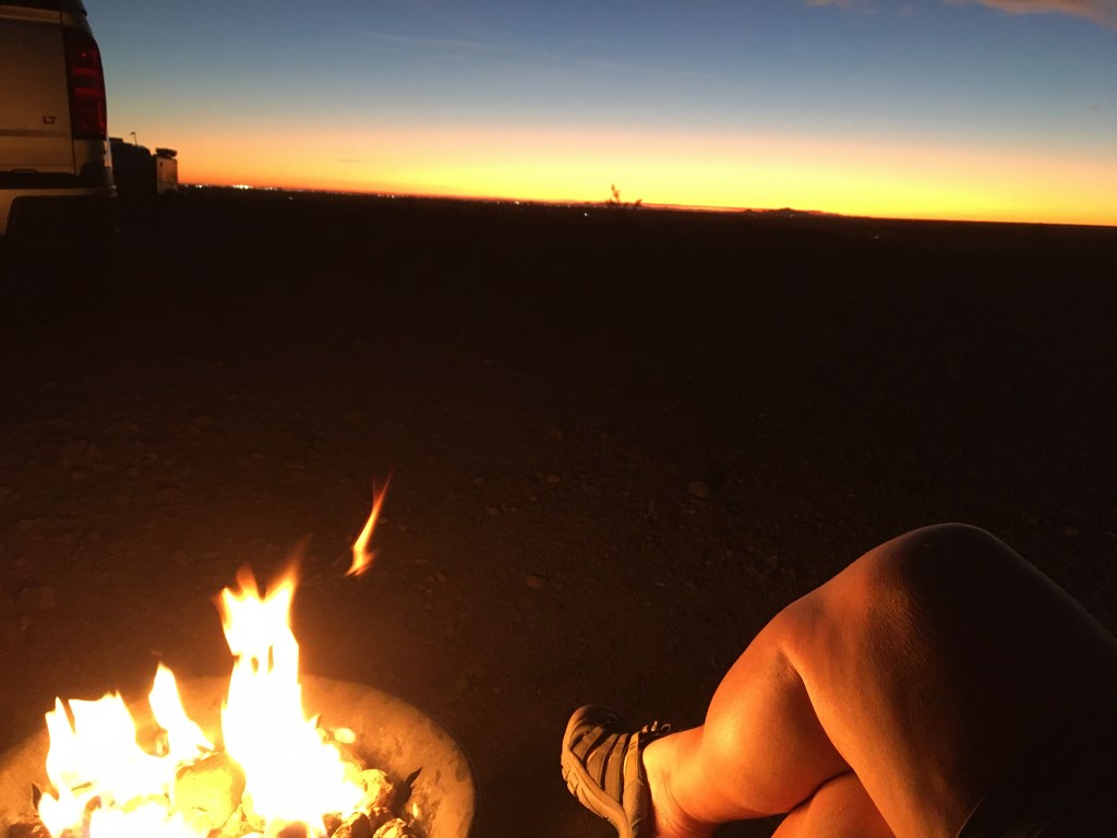
We were headed for Las Cruces as we had heard from another full time RV family that the Organ Mountains right outside of town were gorgeous and there was a fantastic BLM (Bureau of Land Management) camping area on the edge of the mountains. Las Cruces was also a good jumping off point to visit the White Sands National Monument and do some biking. We arrived before sunset and were set up in time for a phenomenal, warm, glowing sundown with a cold craft beer in hand. We were in a secluded, sheltered dip at the end of a windy road that was lined with campers. We had a gorgeous view of the mountains and no view of the campers. Behind us was the orange and red sunset with increasing glow of the lights from Las Cruces.
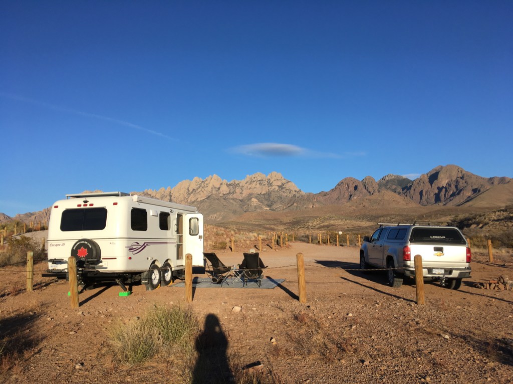

The highways were far enough away that road-noise was minimal, and the setting was quite peaceful. We felt so lucky. We BBQ’d steaks and veggies and settled in to plan the next couple of days. While we were eating, coyotes came close with their high-pitched yelps and whistles that we thought they were after the BBQ. Opening the door of the trailer we could see them 30 feet away then they vanished. We never heard them again close up like that. Next morning, a poopy present had been deposited beside the BBQ. We realized this was a symbolic marker of their territory and their tolerance of us in it.
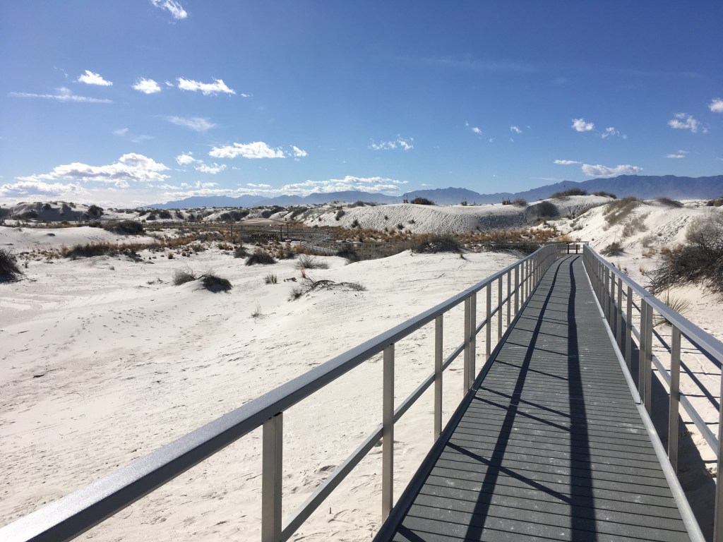
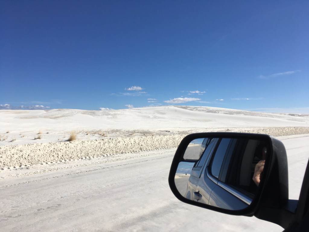
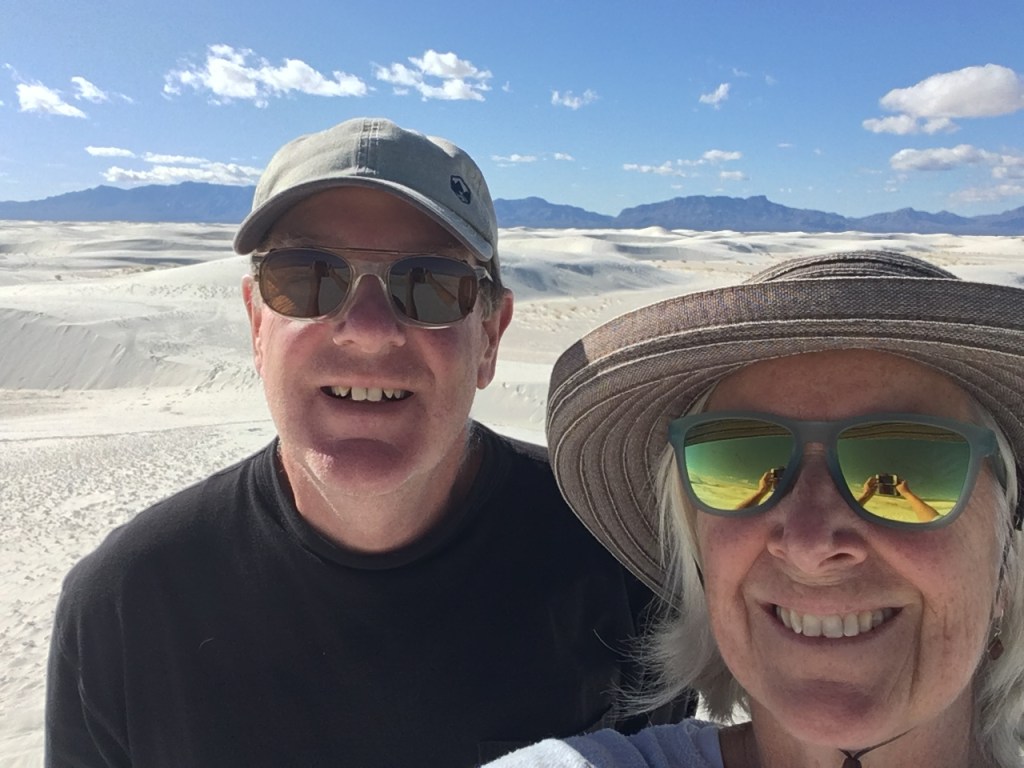
Next day we drove over the mountain pass and on the other side in the valley was the White Sands National Monument. The dunes that are the “white sands” are made of gypsum deposited into the base of the old seabed basin over 10 million years ago. They stretch for over 250 square miles and are part of a buried lakebed that is below the gypsum deposits. This gypsum sand is blown into a huge dune garden that changes with the wind. Much of it is preserved as a national monument (park) and the rest is part of a military testing range. As we approached the dunes in this stretch of Chihuahua desert, they were a messy white with patches of grasses, yuccas and other indigenous plants that survive there. We stopped at the visitor center, got all the info we needed, and headed into the park. As we drove in the plant life changed then became sparser until it completely disappeared, and we were on a snowy white plain with drifts of white sand completely surrounding us. The similarities to snow were quite striking, as far as its ability to blow around and become drifts requiring plows to regularly clear the roadways through the park area. The changing, monotonous landscape confuses some visitors that venture too far from their cars and become lost in the similarities of the landscape around them.
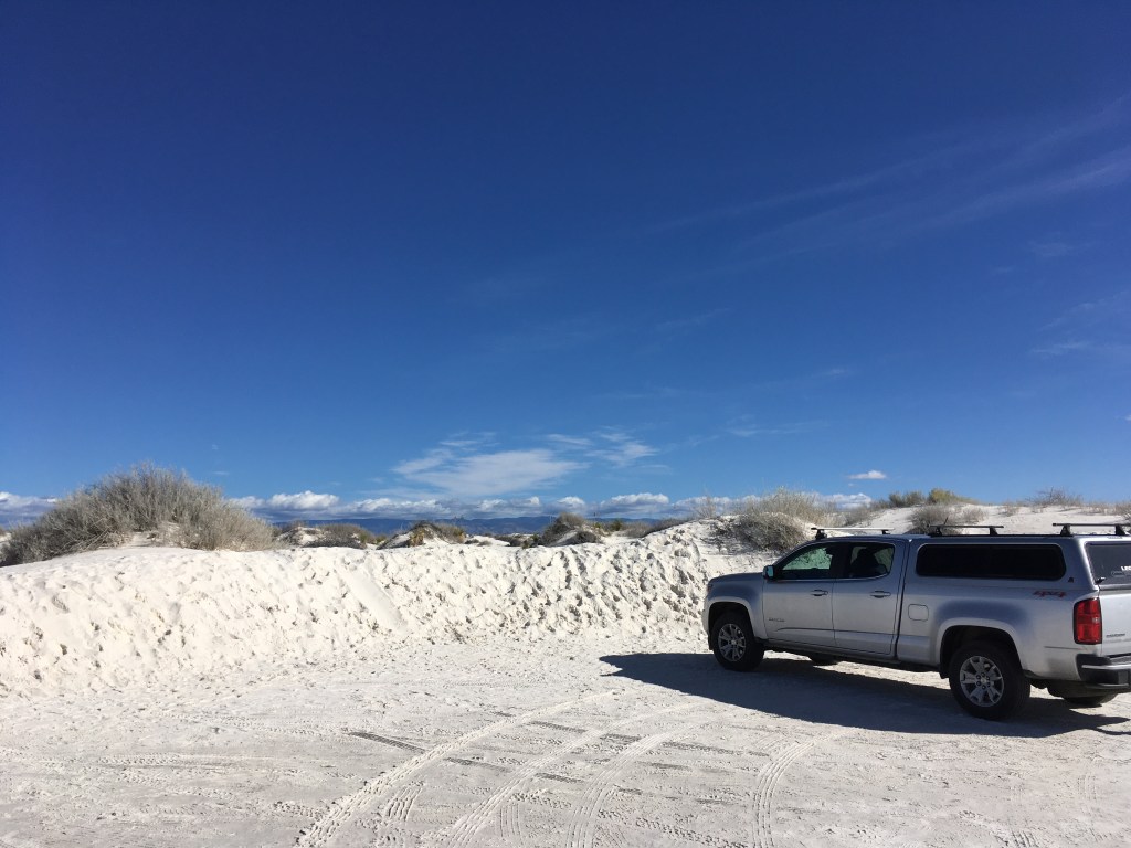
Signs regularly posted along our route reminded visitors to not stray too far from parking areas or marked trails. It was not sand (or snow). Sand is rock and silica. This white sand was gypsum. Drywall. It was in a low area in the desert and as with all lowest areas, water pooled at the bottom. Like a bathtub. Water cools as it evaporates so the gypsum was cool, hard and wet. WIERD!!!!


The park rangers suggested we take off our shoes and walk on it. The “sand” was cold. Because it was wet! In the desert! As we climbed above the parking area, it became “sandy” and warmer. WEIRD!! And our feet were pure white which continued into the truck and anywhere we had touched these dunes. It was like walking on wet drywall and smearing around the drywall mud. We stayed for about an hour, took the photos that said we had seen it and left. It was kind of neat but didn’t draw us to staying for a long time or returning. “Been there done that”.


The next couple of days were spent mountain biking up into the Organ mountains and visiting Las Cruces and Mesilla which is a historical part of greater Las Cruces. Mesilla once held the distinction of being the capitol of Arizona and New Mexico. It was here that we began to really feel the calamity that was the “Old West”. Mesilla and it’s old Capitol Building is also famous for being the location for the legal trial and conviction of Billy the Kid for murder. Cattle rustlers, Stagecoach robbers and gunfights colour the past of the area and mysterious disappearances of lawmen that chased them down are legend. On such lawman and Mesilla icon was Albert J. Fountain who, with his eight-year-old son, mysteriously disappeared from their blood covered wagon near White Sands NM. The culprits were never found but the suspects were members of a cattle rustling gang that Fountain had tried and had convicted. This area was where romantic Hollywood clichés meet gritty gunslinging survival.


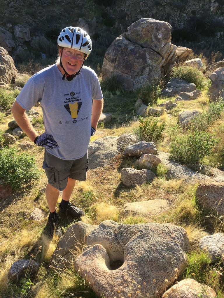
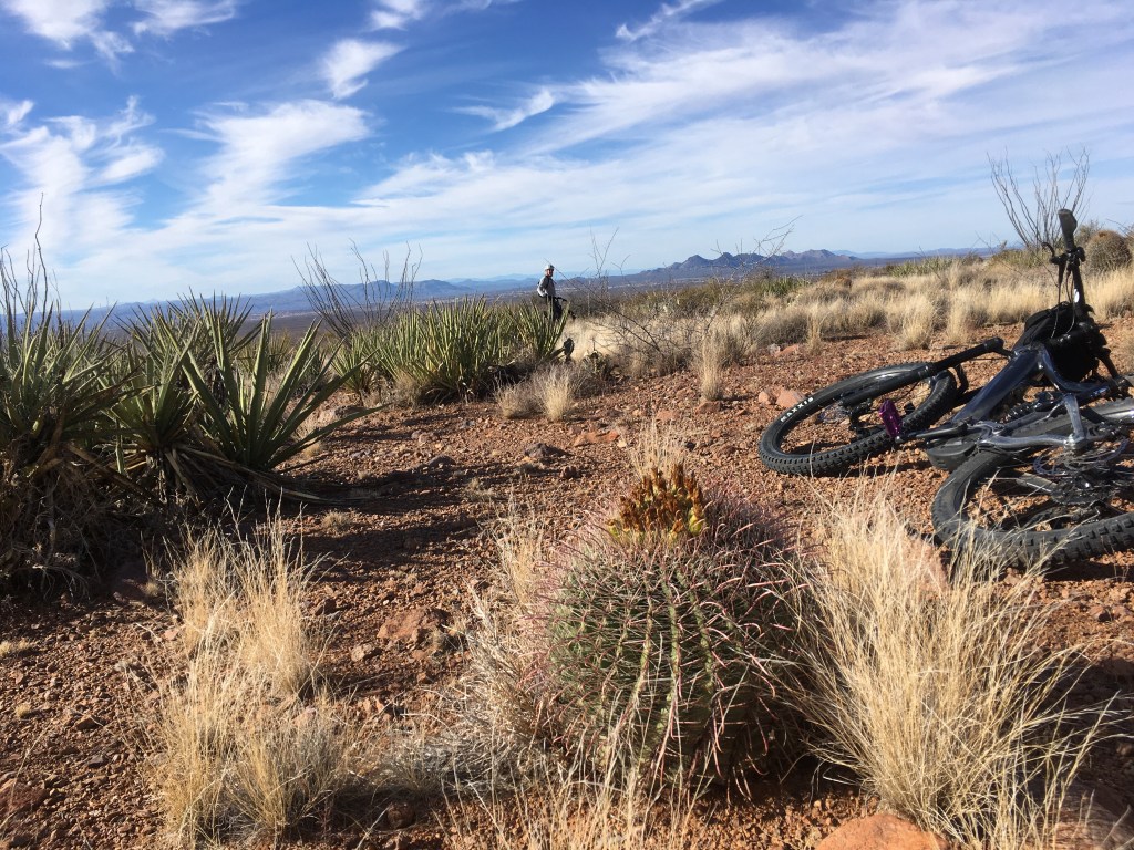
While Mesilla was cute and decorated for Christmas with evergreens and Chili wreathes, it had many reminders of difficult days gone by. While bike riding, the harshness of the desert was paramount. There is an exotic beauty to the gardenlike flora, but nothing you would want to touch or even fall into. Desert riding through gravelly washes are slippery, the Barrel Cactus, Prickly Pear, Ocotillo, Yuccas, Creosote bushes, and countless other unforgiving plants give fare warning not to get to close or be harmed. Unforgiving enough to puncture Al’s tire! The rocky routes that we took through washes and ATV chewed roads managed to plunge me into some road rash and bloody knees. No pain; no gain! Right!?!?! Our BLM site at Las Cruces was one of the more beautiful sites to camp that we had experienced and we may come back another time if we are out this way.


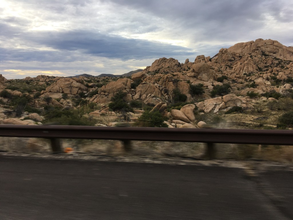
After Las Cruces, we were headed to the Kartchner Caverns State Park. En route we drove through so many different passes that were all different from each other. The most amazing one was a bunch of boulders piled up that made us feel we were in the Flintstone cartoon. The boulders were formed while underground when rains would drain down and rinse away the edges. Over time these carved monuments were pushed out of the ground with the shifting tectonic plates. The most impressive boulder formations along the road were in the rugged fortress called the Dragoon Mountains. This is where the tough and brilliant strategist, Apache Chief Cochise and about 1000 of his followers evaded the blundering US army for more than ten years during the Apache Wars. The “Stronghold” is yet another story of Arizona/New Mexico cowboy Indian army history.
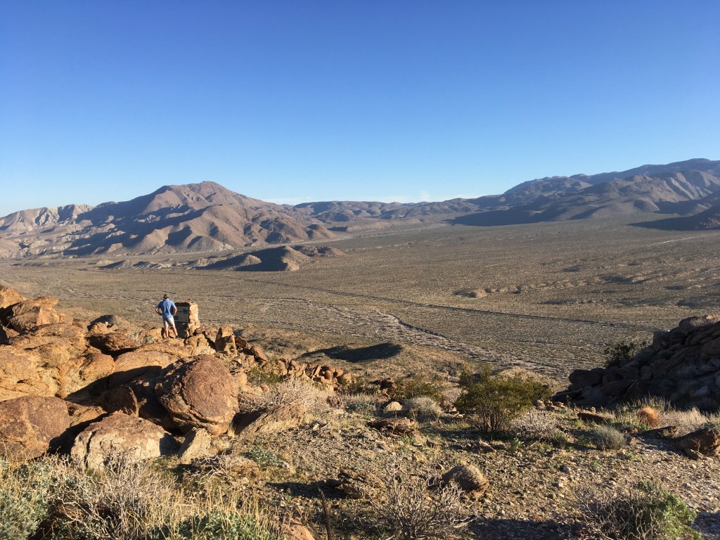
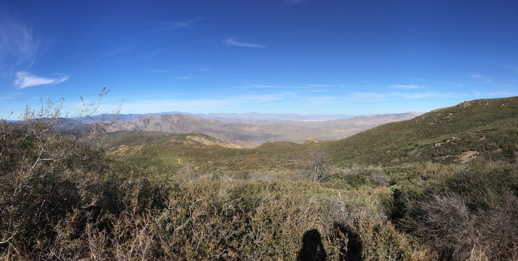
We had heard there was some weather on the way and decided to find a hook up and plant for a couple of days and day trip out from there. The Kartchner Cavern caves are also very famous, but, for shame, we decided not to go below ground. We were feeling like the Carlsbad Caverns were so amazing we had “been there done that”. There was plenty to do and see if we didn’t want to head into these caverns. We went on a beautiful 5-mile desert hike above and behind the campground just before the rains came. We could see as far as the Dragoon Mountains, Tombstone, the mountains surrounding Tucson and far down the valley to Mexico.


The next day we headed for Tombstone and the Boothill Graveyard. This area of New Mexico boasted its fair share of bloodshed. From warring with the Apache, to staking claims on gold, silver and copper, to ranching, to outlaws robbing stagecoaches while rustling cattle from Mexico to the US, and just desert survival, the hardships of the area were paramount. It also bordered the famously dangerous Mexican Sierra Madre where before drug cartels and borders, it was a renowned as a dangerous lawless piece of the world. After reading the book “God’s Middle Finger”, the Sierra Madre didn’t improve with the drug cartels! Tombstone was a town that was a ranching and mining town ravaged by drunken tough guys and ladies of the evening.


The gold seeking pioneer that founded the mine, and ultimately the town, was told “All you are going to find out there is your Tombstone”. Hence the name. The shootout at the OK Corral happened in Tombstone. The town was preserved as a mini museum with actors in period dress, gunslinging cowboys, stagecoach tours, and multiple daily shootouts at the OK Corral, which was really entertaining. Over the years all but one building were destroyed by fires but you wouldn’t know it. As you wander the few streets that portray the old west with saloons, brothel boutiques, and candy stores, you have to commend the locals who have turned what could have been one of the area ghost towns into a viable busy tourist destination. There is a local craft brewery, a historical society, multiple restaurants, museums, and the Boothill graveyard where all the “bad guys” are, including the McLaury brothers and Billy Clanton, killed October 26, 1881 at the OK Corral. The memorable “good guys” that shot them were the Earp brothers Virgil, Morgan and Wyatt plus Doc Holiday. It is hard to know who the good or bad guys were, but the re-enactment had the sheriff running the saloon and the Doc visiting his consort….


The graveyard was a fantastic visit. The grave markers were maintained in a rickety fashion and the map of the graveyard told the story of pain and peril. Not sure where the uppity class were buried but we heard there was another cemetery that held the upper crust folks.
Kartchner Caverns campground was about an hour south of Tucson Arizona and we hadn’t yet been to Tucson. We decided to drive via the southern entry and visit the Spanish Mission San Xavier del Bac, one of the first Spanish Catholic missions built in North America by the Jesuits in the late 17th century. After that, they were run out by an Apache raid the Franciscans took over about 100 years later. The building is the oldest European building in Arizona.
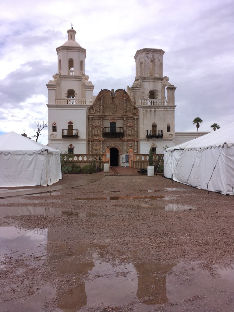
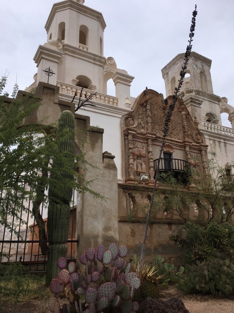

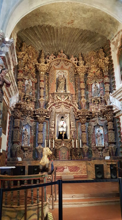
There was a very active historical and restoration society that was working on restoring the buildings to their traditional mud plaster architecture. The Spanish architecture with Indigenous folk-art was indeed novel as the paintings and carvings depicted the style of the local people rather than the white Jesus of most churches. Overall the religious tone felt laid back and cozy with the folk-art influence from generations of mixed race cultures – Spanish, Native American, Mexican and British. We found a delicious Mexican restaurant for lunch in South Tucson and headed back to the trailer.
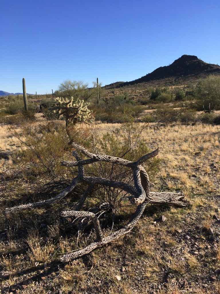
Next day we headed out of the Chihuahua Desert and into the Sonora Desert. The Sonora desert had the iconic Saguaro Cactus popping into view often in numbers we considered a forest. We found a BLM site just south of the highway, but we also realized our gas tank was close to empty. Google sent us to a gas station along the highway, but it wasn’t a gas station yet or anymore. There was a pony tailed, elderly hippy, “kind soul”, supervising some others working on a car. He limped over and advised us to go 20 miles up the road. He had a friend in Canada! We got the sense that he was just as happy killing folks as meeting new folks. We made our way and passed hundreds of thousands of cattle that were destined for American dinner plates.

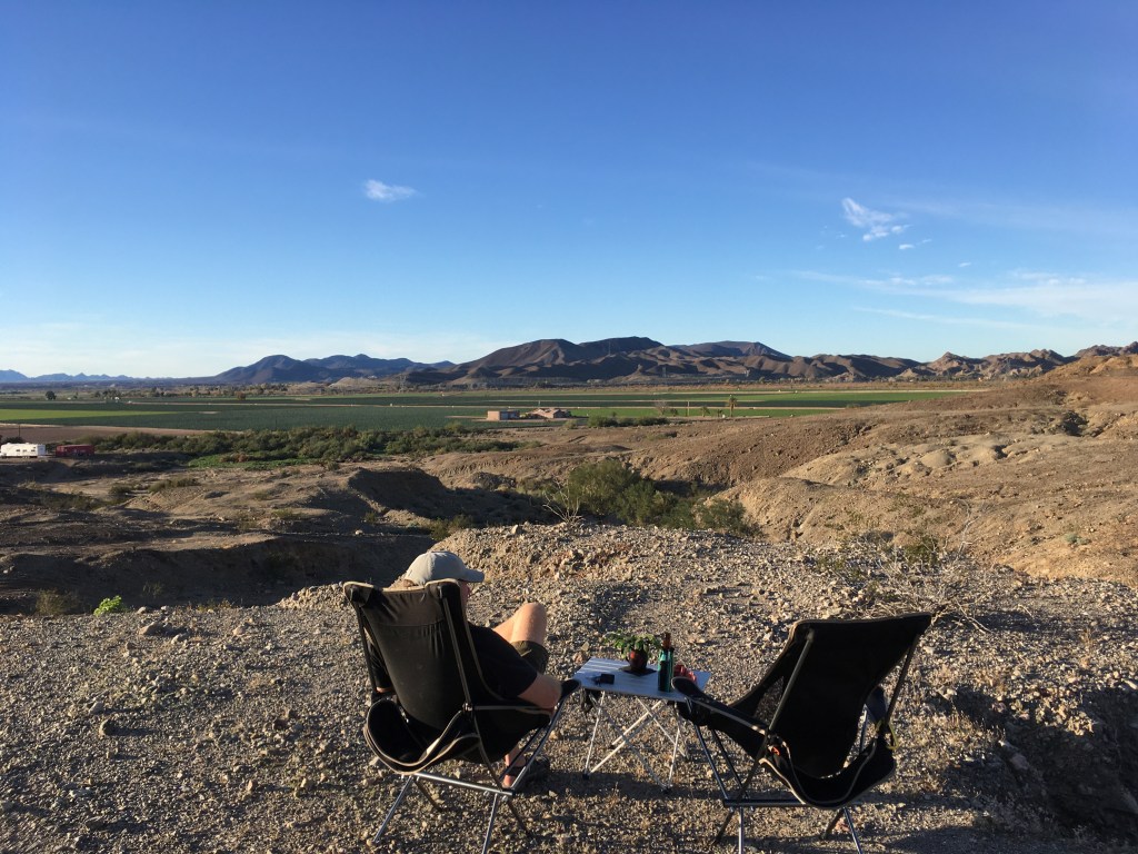
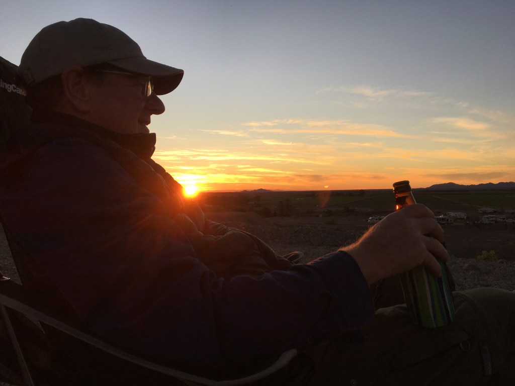
Gassed up, we headed for the BLM and our friendly saguaro cacti. While camped there we hiked over land to a rocky outcrop and caught the last of the day’s sunshine.


Next day we headed to desert number three, the Colorado Desert, and the town of Yuma in the heart of the Colorado desert with the famous Colorado river sliding through the town as it nears its exit into the Sea of Cortez in Mexico. At the tourist information stop, there was a train display immortalizing the fact that Yuma became a destination because there was a relatively easy pass to build a railroad to get over the Colorado River and to the Pacific Coast. Yuma, in Arizona, sits on the US / Mexico and California, so it was warm, cheap and full of delicious Mexican food. Yuma’s topography included a maze of dykes and rerouted Colorado river channels surrounded by mountains that were old volcano cones and farmland.
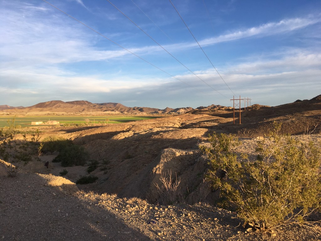
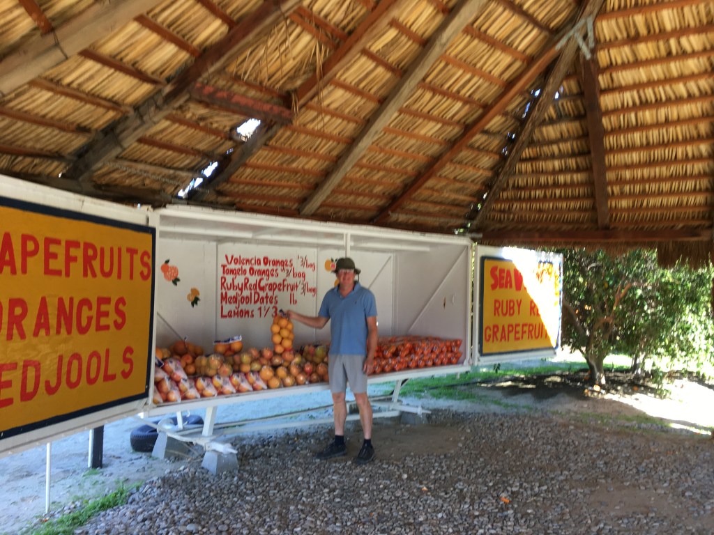
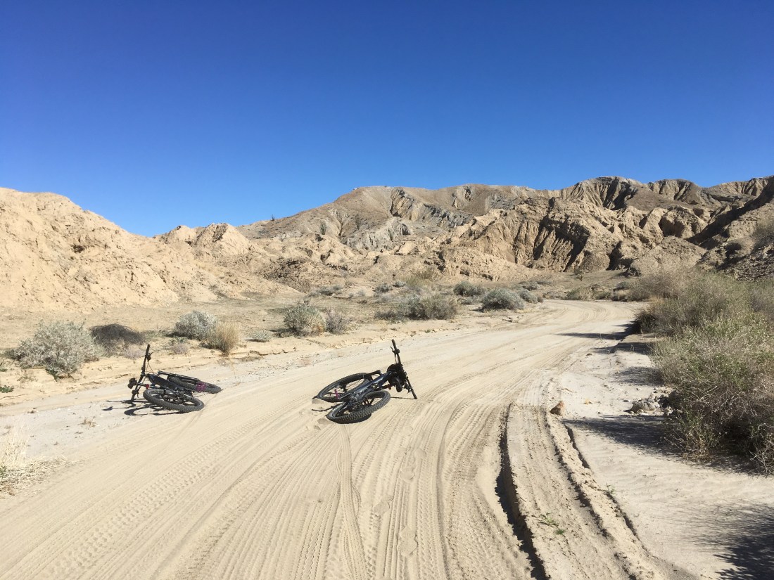
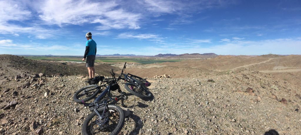
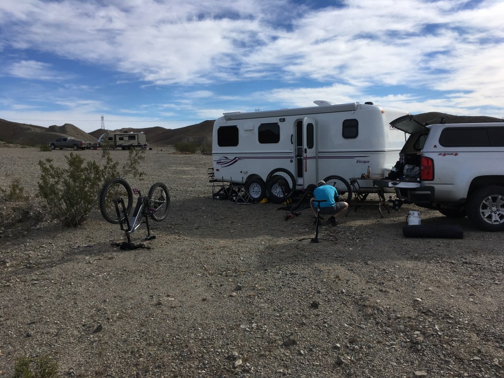
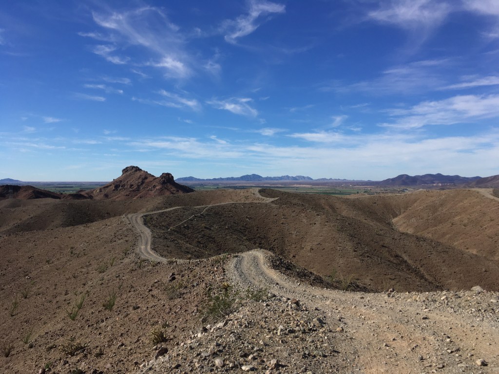
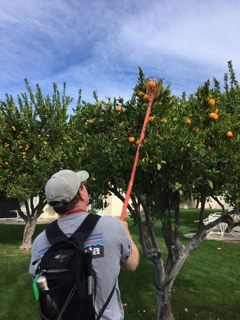
There was dry barren desert contrasted by hundreds of acres of rich agricultural land composed of citrus groves, broccoli, spinach, cauliflower, kale and lettuce fields. All this agriculture was made possible by irrigation from the diverted Colorado river. While driving along the highway it was obvious that the main source of housing was similar to ours and that the people are only here for a few months. RV parks were everywhere. We barely saw any houses. We found a BLM site above the farmlands and the irrigation ditches and stayed a few nights. Our neighbours in the BLM were all snowbirds enjoying the free camping and many of them had OHV (Off Highway Vehicles) quads and dune buggies. All of these quads had 70 something year-olds and licence plates on them so they could also take them on the roads. The trails through the badlands behind the BLM was double track that had all been chewed up by OHVs and made mountain biking on them challenging. Imagine a solid sandbar being stirred up and mixed with rocks on a steep incline. I tried riding it but mostly pushed my bike up and down the trailways. I was so demoralized. From a distance it didn’t look difficult but when you balanced yourself on a two wheeled bike after the quads had taken the blender to the surface, it was really unstable. Even Albert had to renegotiate a few of the hills. Nothing but hard surfaces and cacti to land on if you bailed. I wept.
So, we headed to the lower terrain and decided on a margarita instead of killing ourselves. When the sun went down the UFO’s arrived. Not really but in the dark the airplanes with large strips of floodlights were buzzing the fields below us. These crop dusters were a marvel in aviation skill. The hazards around the fields were not just the mountains but there were electrical wires flanking every field. Reading about them later we learned that many of these pilots had perished from plane crashes and the effects of toxic chemicals they were distributing in their back draft. These occupational hazards had been reduced now that computer and GPS systems were so precise. Electrical power line locations are now programed into their flight plans and sensors measuring moisture, insect infestation and weather conditions in the fields are all considerations in the administration of pesticides or nutrients. These efficient programming tools make mapping the planes route over the fields more effective using fewer toxic chemicals also making it cheaper and healthier for pilots, farmers and consumers. In addition, only fields with a problem were dusted. These amazing pilots were pretty fun to watch. Like dragonflies over a pond.
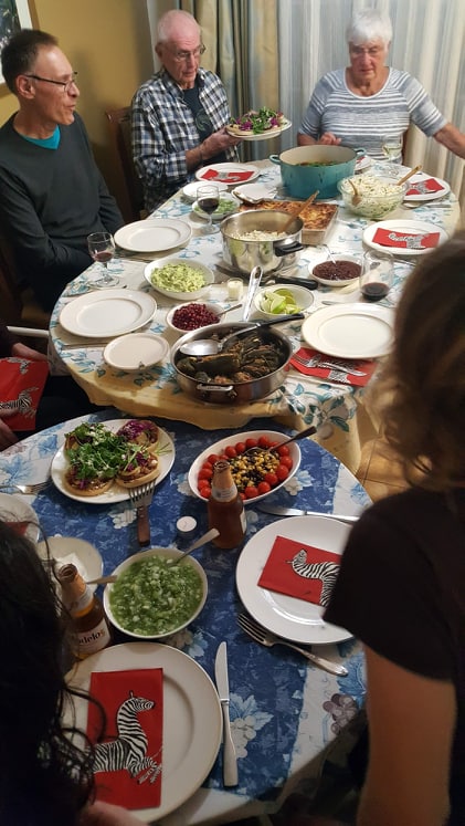
After Yuma we were nearing our planned Christmas destination; Palm Desert for three weeks. Last year we booked the last of the time left on our inherited timeshare at the Desert Breezes resort on the border of Palm Desert and Indian Wells. Across the street from the resort was the huge Indian Wells Tennis Garden where the US open and countless other tennis tournaments are held. Marnie and Jim (my sister and her husband) were joining us. And for the one Christmas week, we had their daughter Quin, and our Mum and Don. The rest of our children were not able to join us.

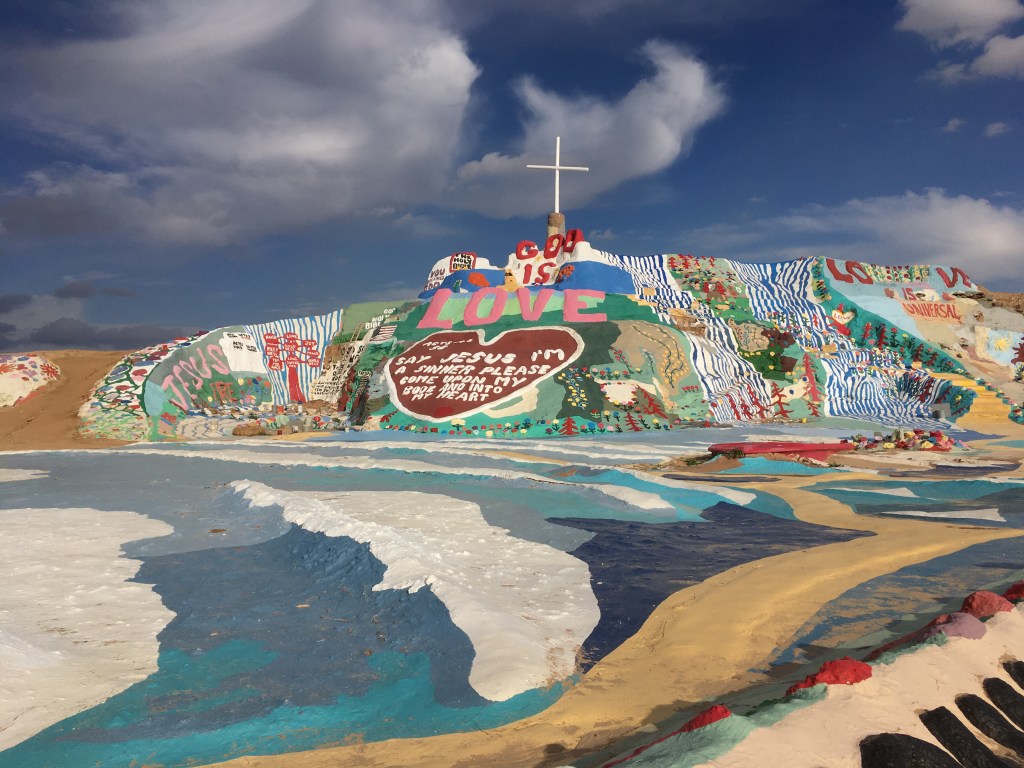
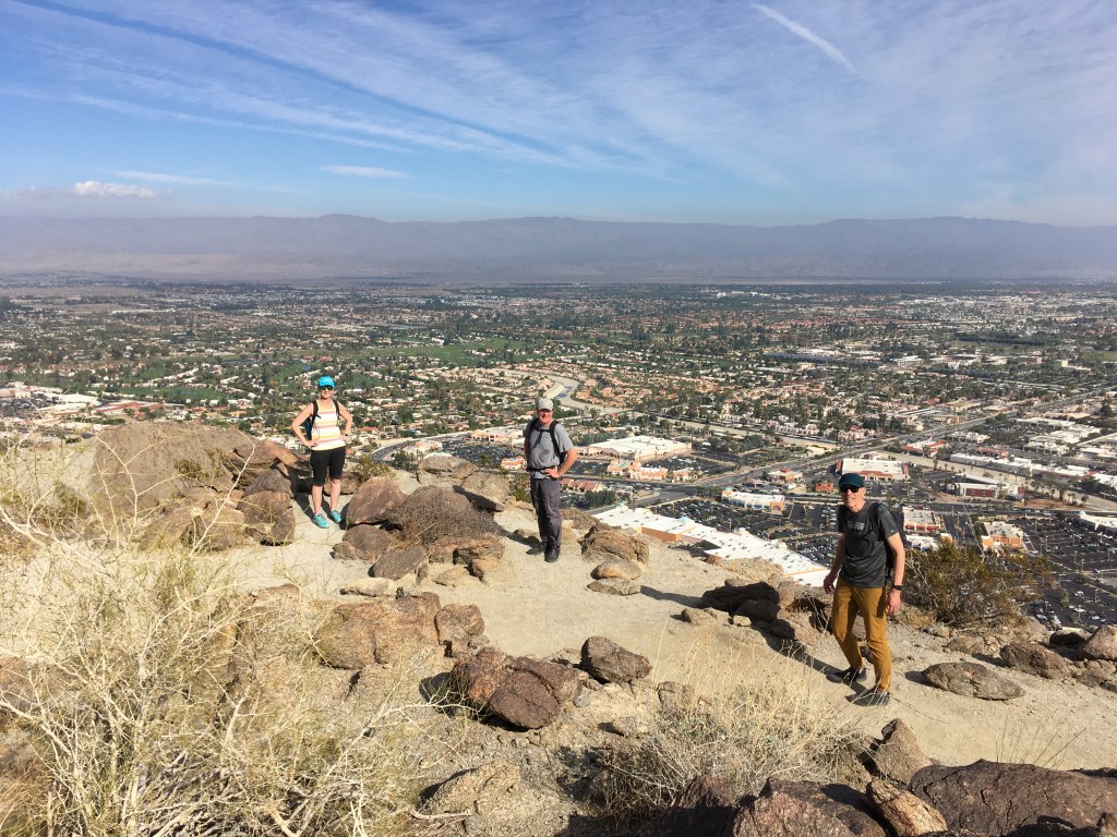
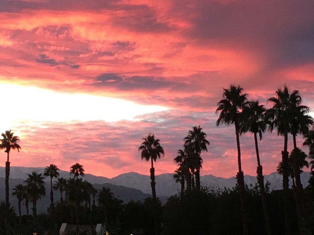
Greater Palm Springs aka the Coachella Valley, is a large valley oasis with deep aquifers, 9 towns and more smaller communities. There are many manmade lakes, golf courses, and most of the streets are walled, gated and closed to non-residents or non-members. It is very clean, tidy and antiseptic. We are not golfers and to be honest we were concerned that the area may not be “our thing”, although Christmas in a warm desert environment seemed like a great idea. But WOW, did we find lots to do!! Surrounded by the San Jacinto Mountains, Joshua Tree National Monument, the dead Salton Sea, the Mid-Century Modern architecture, artsy walks, movie star homes and the hillsides and oases that were the result of the San Andreas fault tripping through the area, there was hiking and discovery everywhere.

We hiked up a trail overlooking the unique and impressive previous home of Bob Hope. Although it is someone else’s home now, it is still known as Bob Hope’s house. One day no one will know who Bob Hope is and they may call it something else. We hiked the Cactus canyon up near the Pignon tree line in the San Jacinto mountains. We hiked into a canyon wash along the Palms to Pine highway that narrowed as we ascended and saw, above us, a flock of bighorn sheep.


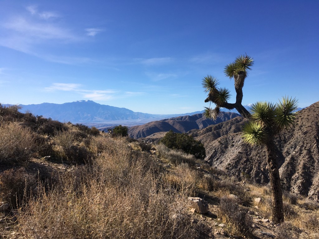
We drove through Joshua Tree National Park from south to north seeing the transition from Colorado desert to Mohave desert where the unique Joshua trees grow. We stopped and hiked to a palm oasis at Cottonwood Visitors center. We looked out over the whole Coachella Valley that encompasses greater Palm Springs all the way to the Salton Sea. We returned again after a snowfall in Joshua Tree and took sunset shots on the gorgeous rocky outcrops with snowy fields of these Dr. Seussesque cartoon trees.


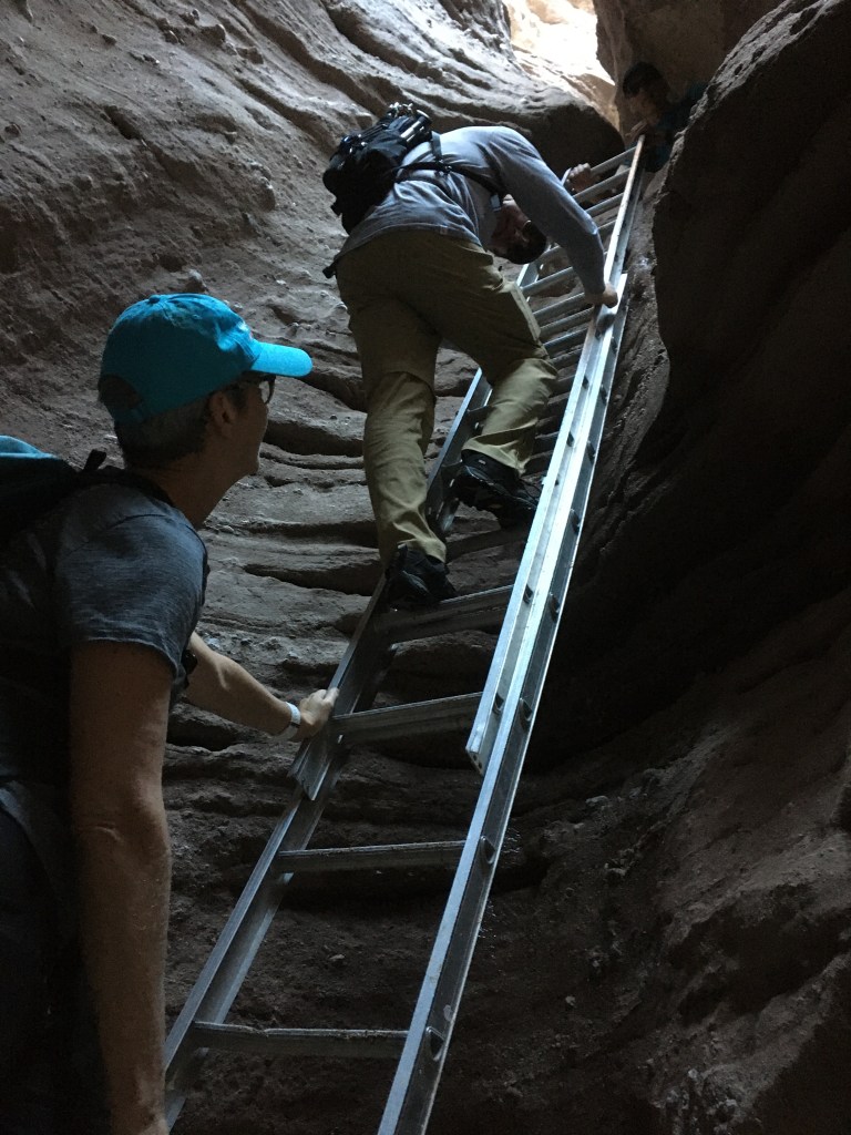
We hiked the “Ladder Canyon” driving around a sandy, washed-out road. Then parking beside all the fancy cars (weirdly including a Jag, Bentley and many Mercedes) in the sand and gravel up the canyon. It was a hike up the canyon wash, to a ridgeline overlooking the Salton Sea and the San Jacinto mountains, then down through a slot canyon in the Mecca hills which are on the San Andreas fault. This is the same fault line that hugs Vancouver Island. We hiked along the trails beside the Thousand Palms and through a creek running between them. These huge California palms occur when there is a water source up to twenty feet below the surface. The San Andreas fault has many fissures underground that form wells where these trees grow. Sometimes they were even growing out of the sides of the hills rather than at the valley floor which seemed out of place when we saw them. They were messy and so foreign to the orderliness of the greater Palm Springs cities.


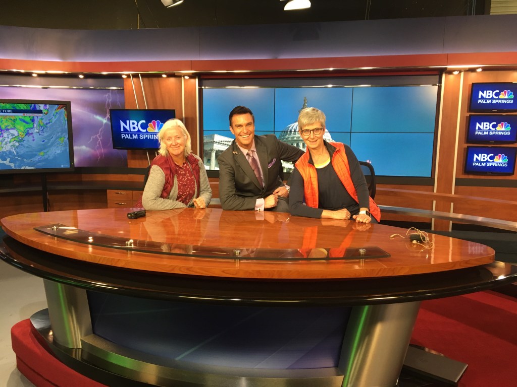
Our cousin, Mike Everett, is the meteorologist for NBC Palm Springs and one evening we were invited to tour and watch the newscast in studio.


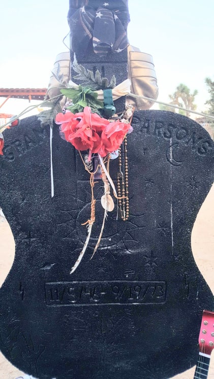
Christmas this year was a completely different with no presents, a Mexican feast on Christmas Eve and another drive through Joshua Tree on Christmas day with our extended families. Quin’s partner Liam, lives in LA and his family visiting from Portland. They were staying in the town of Joshua Tree and joined us for Christmas Eve dinner. They were staying at the iconic Joshua Tree Inn where influential country-rock musician, Gram Parsons took his life with morphine and alcohol. We stopped to visit on our way past on Christmas day. There was a memorial at the motel, thus making our foray into dead musician memorials a thing.

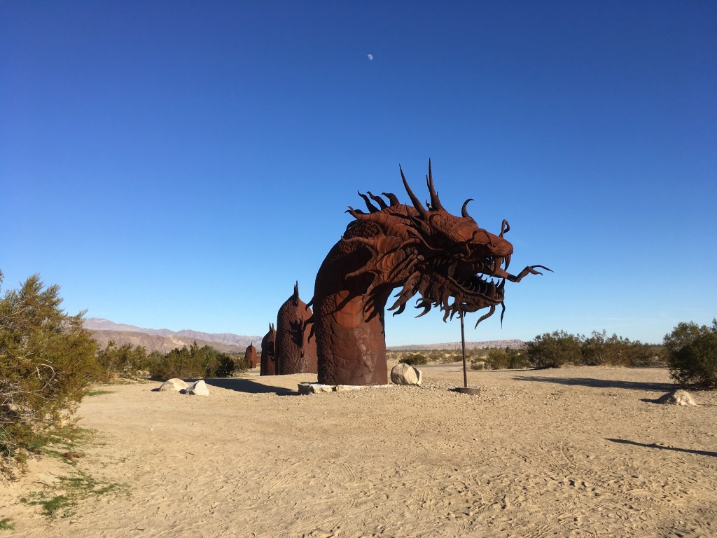
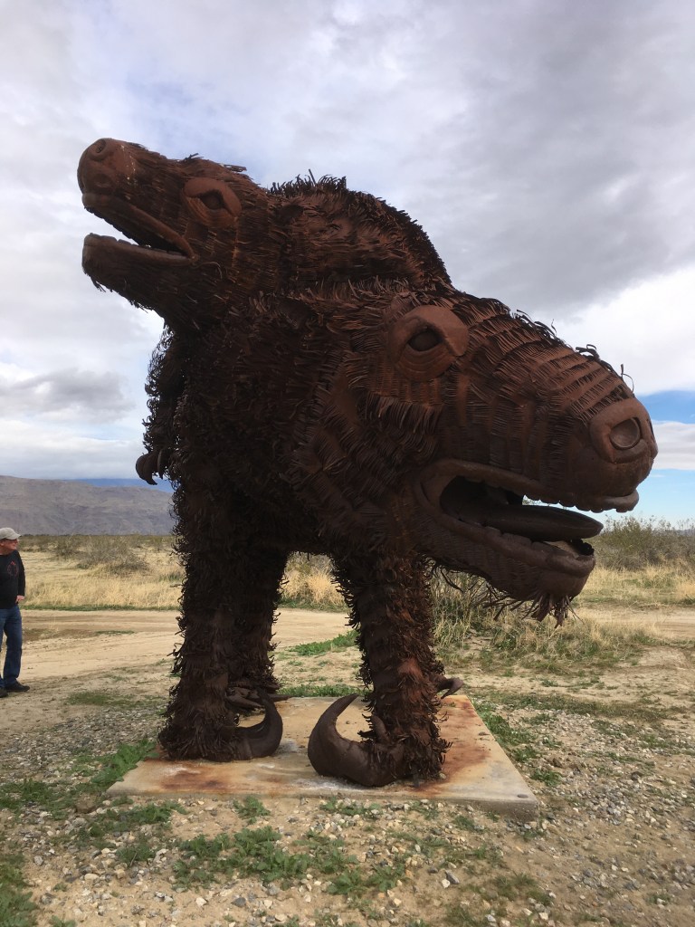
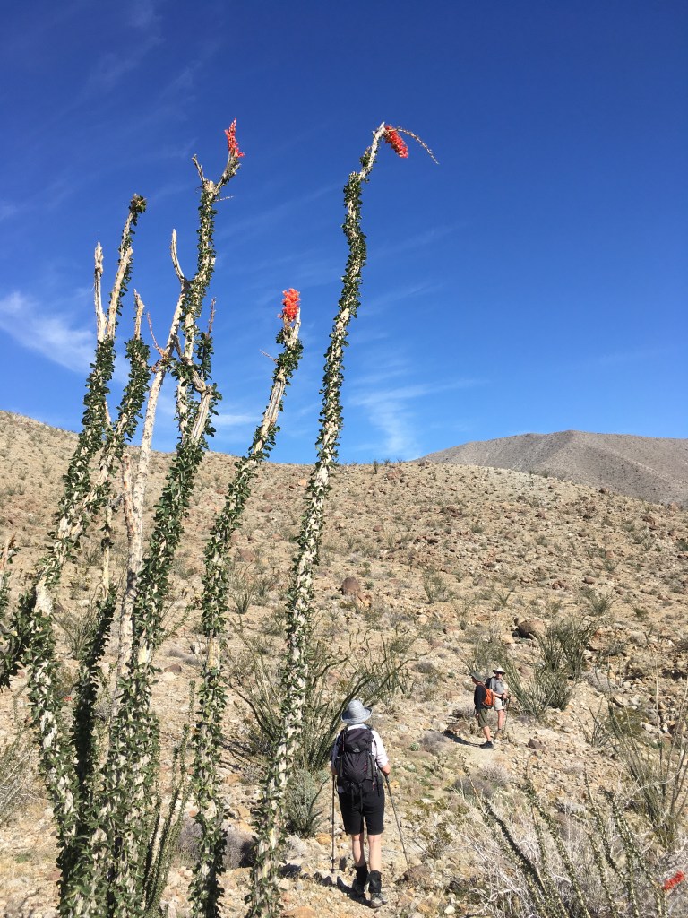
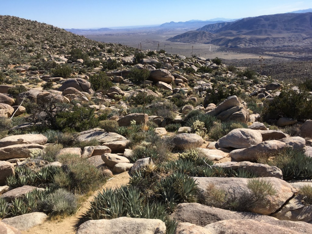
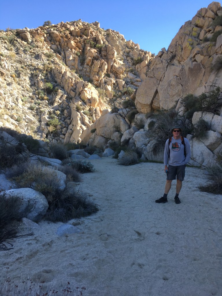
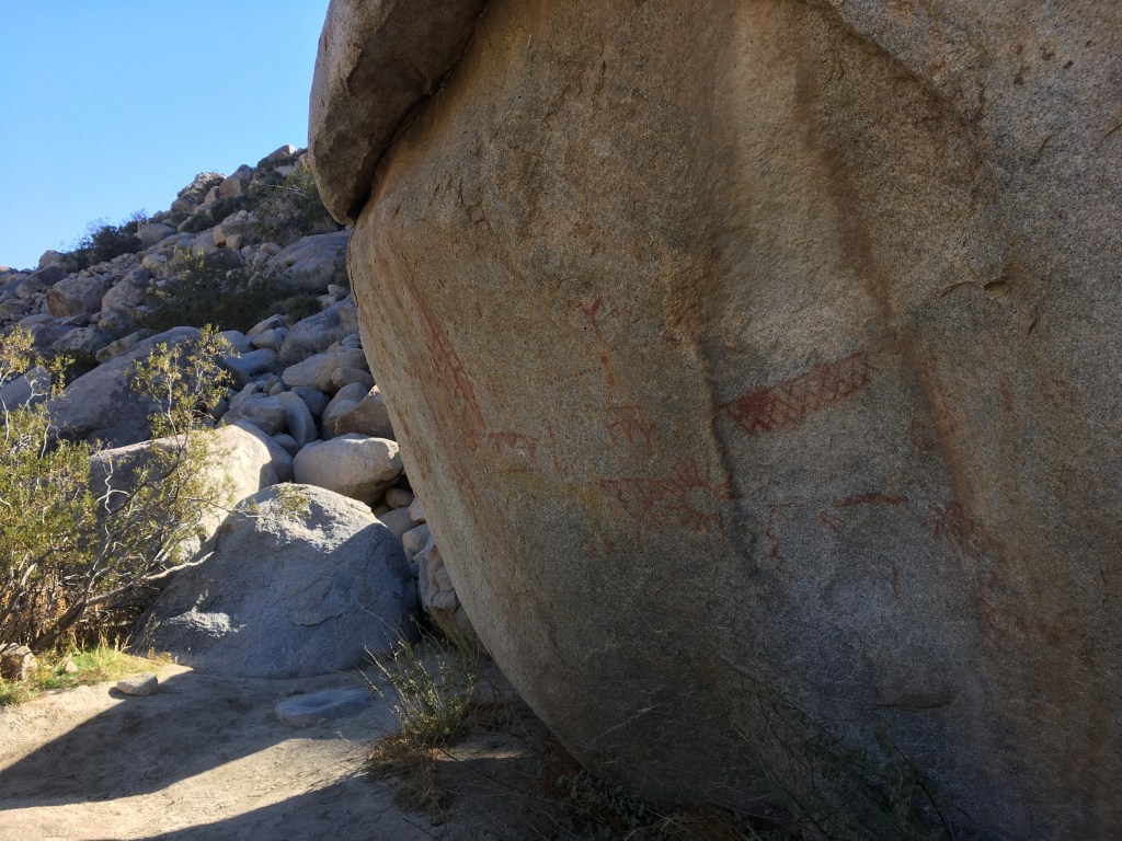
Jim returned to Calgary on December 29 and Marnie stayed on until after the first week of January. Our timeshare finished up on January 3rd so we took Marn camping in the desert. We headed to the Anza Borrego Desert State Park and with one trip back to send Marn home, we have been there ever since. What a park!!! With Marnie, we stayed at the Borrego Springs State Park Campground with full hookup for three nights. There was a beautiful 3 mile hike into the valley behind the park with a waterfall and more California Palms with their natural hula skirts draping to the valley floor. The town of Borrego Springs originally had a development plan similar to Palm Springs and it is dotted with a few golf communities, mid century modern neighbourhoods, farming and a lack of water to sustain growth let alone to support the community as it stands. We tootled around the few streets and round-about that make up the town of Borrego Springs, went to an art opening and a drive through the Montezuma highway to the Old Stage Coach road and the town of Julian for pie. Julian is famous for apples and pie. It is on the highway to San Diego and we were there on a holiday Sunday so it was an absolute zoo. We didn’t stop and kept driving a further three miles to quiet Wynola where we found a bakery with DELICIOUS APPLE PIE!! Topping it with cinnamon ice cream, we had the perfect lunch and returned to the campground.
Here are some of our favourite hikes and places in and around Anza Borrego Desert State Park. Our journey north begins next post.