
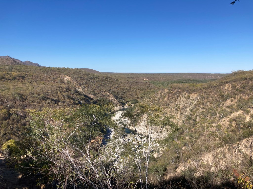
After Todos Santos we met up with our pals at a small hamlet called El Chorro in the mountains behind Santiago. Mostly gringos live in this little area near the river with hot water bleeding out of the rocks and are captured in rudimentary pools to relax in. A campground was near the river so we found a spot and wondered when we would see an official to pay. A few years ago, legend goes that there were a couple of deaths by drowning in the river so the campground was closed until they could or would staff a lifeguard. This wasn’t going to happen, and the road is open so now it is more of a day use area for the locals. It is in the national park so normally 200 pesos per person but since it closed no one collects, so no charge. We camped there for five magnificent nights.
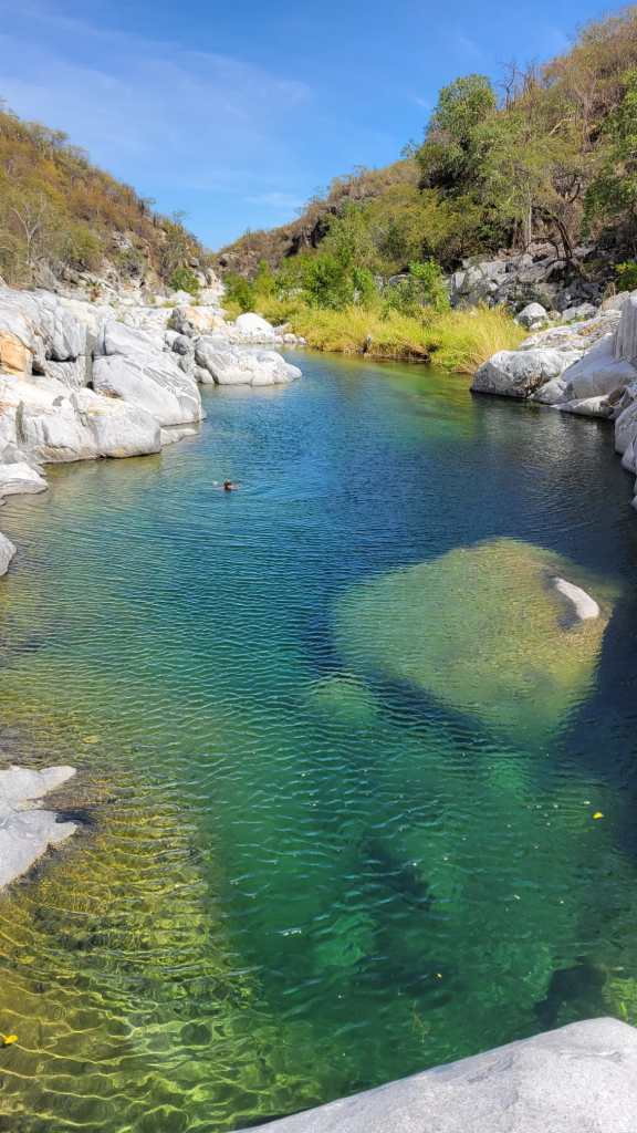
A walk up the canyon had us diving in the cool clear water.
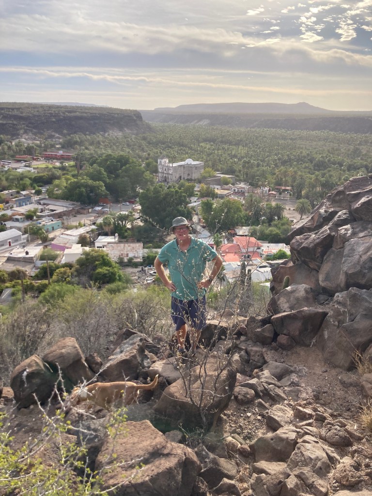
There was a sandy beach and lovely swimming with an adjoining hot, (natural) thermal spring for lounging in. Can you see our trailer way down the valley by the dam?

We had great celebratory meals and laughed at some of our antics together over the month or so we have traveled the Baja. One such meal was at a local ranch called Campestre Vinoramas. This local treasure is about a half hour drive from our campsite and came highly recommended from local intel. They only open on weekends and so, it being Sunday, we thought an afternoon visit was just the way to wrap our long list of fabulous repasts. When we arrived, the place was quiet with only a few locals seated under a very large outdoor canopy.
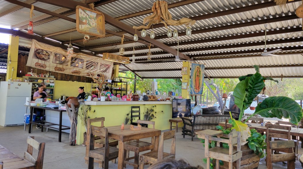
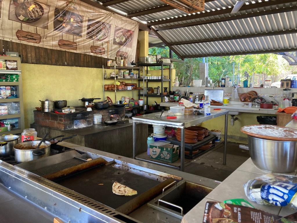
This impressive structure encompassed a large dining area, a cooking area, preparation/ service area, and commissary partially visible from our seats. The gardens had roses, numerous flowering Bougainvillea, and many cacti and Agave. They had a herd of goats, an ostrich, donkeys, cattle sang with the roosters and chickens. Queso from the goats was on the menu in the rellenos. Wood fired comals (a grill) kept pots hot and tortillas grilled. Five women of differing ages provided our comida. Fresh strawberry juice, orange juice from the nearby trees, and honest local fare done well. Surprising, considering we were out in the middle of nowhere halfway to the imposing mountains that provide the back drop to the desert sands on the East Cape. No Cervesas on the sabbath but the fruit juices served were delicious and satisfying in the midday heat. We ordered two different platters to share taking half home for later. Lunch was enough to take us through to breakfast the next day!!

As we retraced our steps we stayed a couple of nights by the airport in Loreto. On one of the days we took a drive into what we had heard was a palm oasis just above where we were camped. Oasis Primer Agua was a resort with a huge pool built in the middle of the arroyo. Probably a bad idea since a couple of storms around 2004 created such a surge that it was damaged beyond repair. The area is a conservation area now and while we were walking around we managed to see a fox that was unconcerned with our being there.


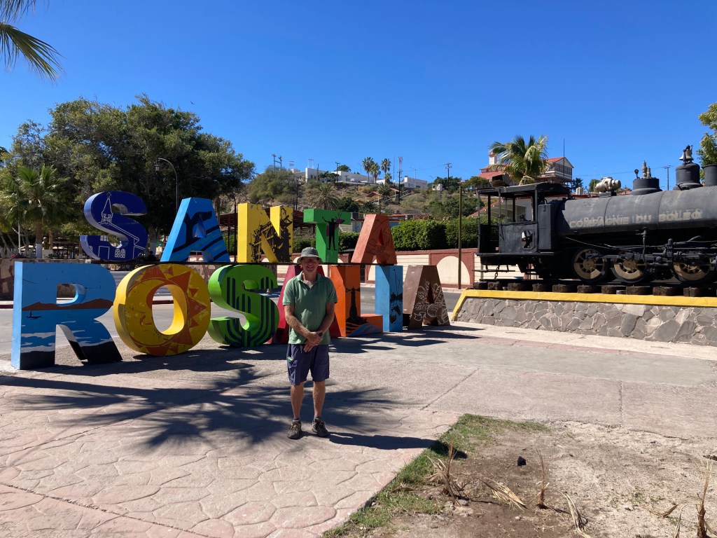
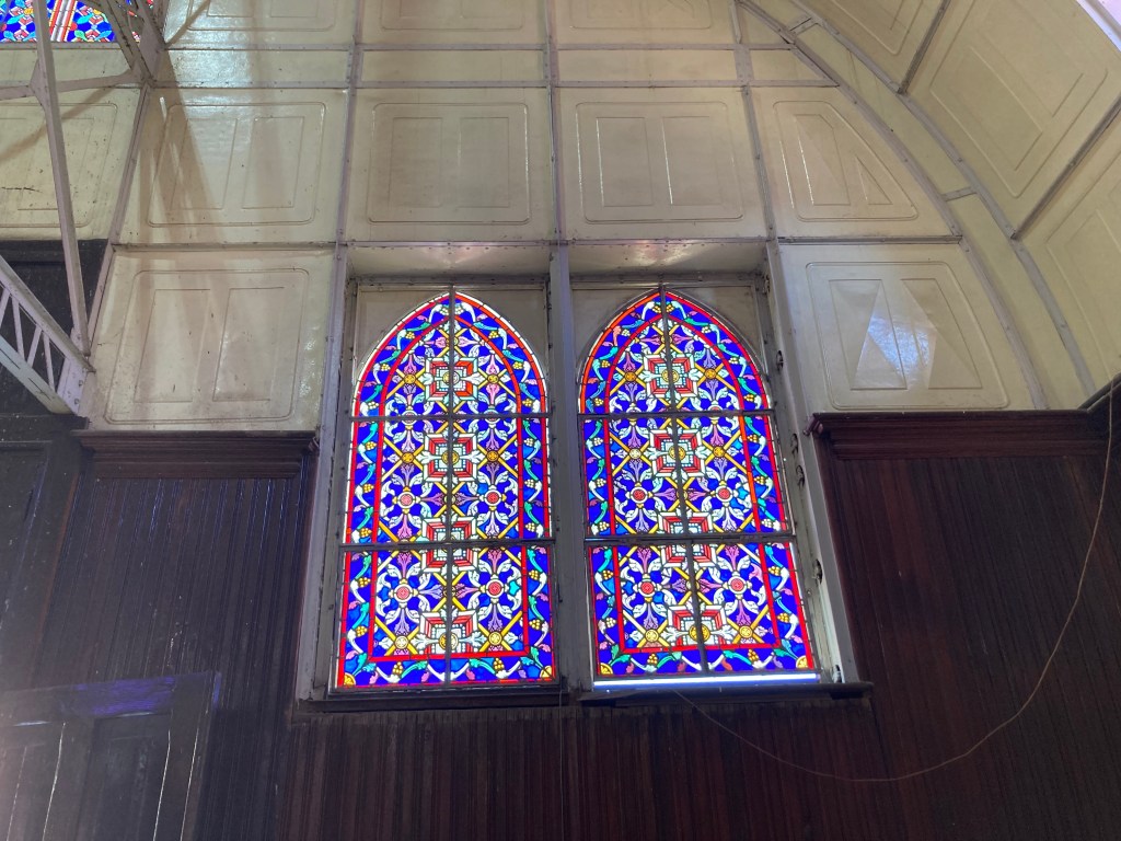
More retracing of previously interesting places on our way south, included Santa Rosalia and this time we wandered the streets of the old mining town. This Church was renowned to have been designed, constructed and dismantled to sail to Santa Rosalia by Gustav Eiffel (Yes, of Eiffel Tower fame) where it was erected over a century ago.


We missed the famous bakery by about 20 minutes. Sadness. Had we known!!!

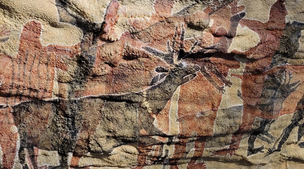
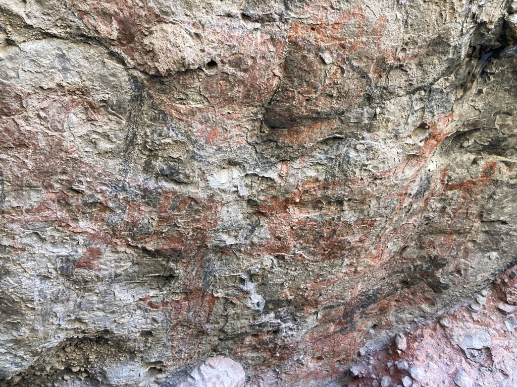
Next steps to retrace was San Ignacio. This town was considerably quieter than when we caught the Baja 1000 racing through. We decided to stay a few nights so that we could day-trip out to see the rock/cave paintings at the Sierra de San Francisco mountains. In San Ignacio there is a museum beside the mission church that has a model of and information on 3000-year-old cave paintings and now we had the chance to go see them.
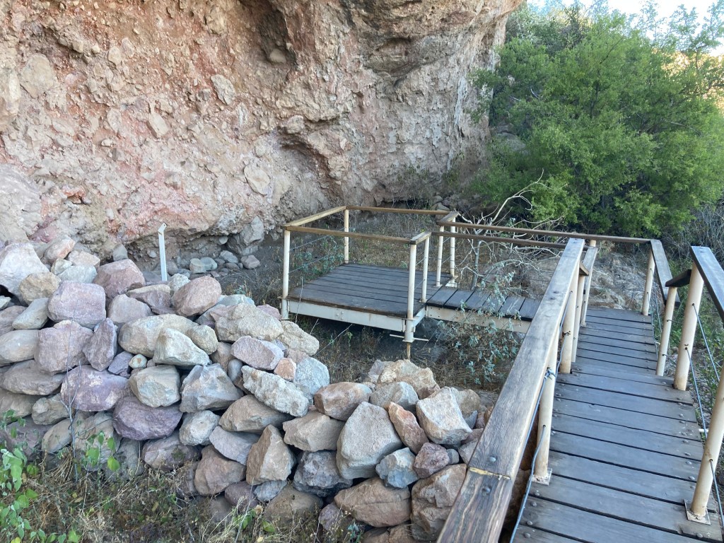
The drive from the Highway One flat dusty Vizcaino desert into the “Sierra” (mountains) was spectacular. The road was beautifully paved and if there were potholes, we didn’t hit them or see any to hit. Arriving at the cueves (caves) parking we were instructed to go to the “hostel”, pay, then come back with a guide. All of this was in Spanish so we left looking for a hostel and hoping someone would be able to explain. We returned with Carlos our guide. Unable to communicate as he spoke no English, and I attempted to use my Spanish he just smiled. I think he may have been hard of hearing so our level of communication was further hampered. That was Ok because the paintings were very cool. Self explanatory…


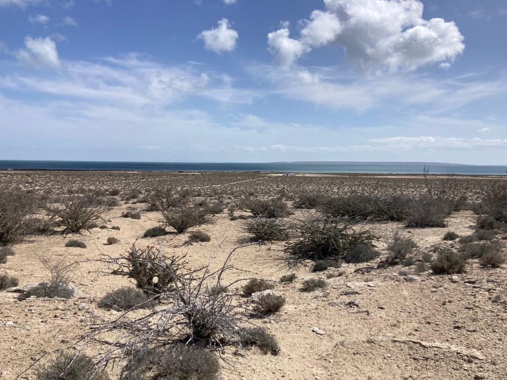
Guerrero Negro is a town near the border between North and South Baja. It has an enormous bay and salt flat that forms the largest salt pans and salt extraction in the world.

But the reason we were going to the bay was the Grey Whales. Grey whales calve and breed in Ojos de Liebre Bay where the high salinity of the bay allows for increased buoyancy thereby assisting the whale calves while nursing. Between January 1 and March 31, the public is able to camp and go on a whale watching tour. It took us an hour to drive the 16 km sand road to the campground and whale center. The dunes and scrub on the flat land felt like we were on the moon. A few campers were around but the wide-open space made us feel like we had the place to ourselves.
Next morning there were enough people to fill six pangas (boats) with 13 guests each and away we went! Grey whale’s yearly migration from the Baja to the Bering Sea begins again in April swimming a speedy 8 km per hour. The grey whales seldom travel the inner waters of Georgia Straight, so this was super cool seeing their barnacle encrusted bodies and black skinned babies. Spectacular when the whales came up beside us or swam upside down under the panga. Show offs!!
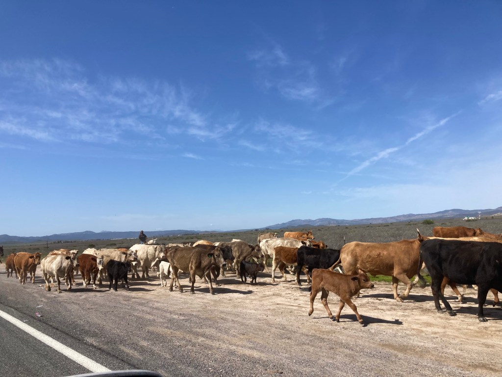
A few days later we had crossed the middle of Baja and were headed to the Valle de Guadelupe, Mexico’s wine valley. We decided to take highway 5 up the east side as we heard the road was better than the west side, less traffic, and we knew lovely free places to stay from our trip south. We stayed one night at our first Baja beach, La Poma at Punta Bufeo. Quiet save for the waves lapping below our parking spot. Next morning we hit the road. North of San Felipe is a secondary highway (#3) that goes up and over the mountains to the large city of Ensenada. This route has ranching, cattle, goats, desert, huge rock formations, and potholes. Lots of potholes. Recent rains hurt the roads and greened the pastures.


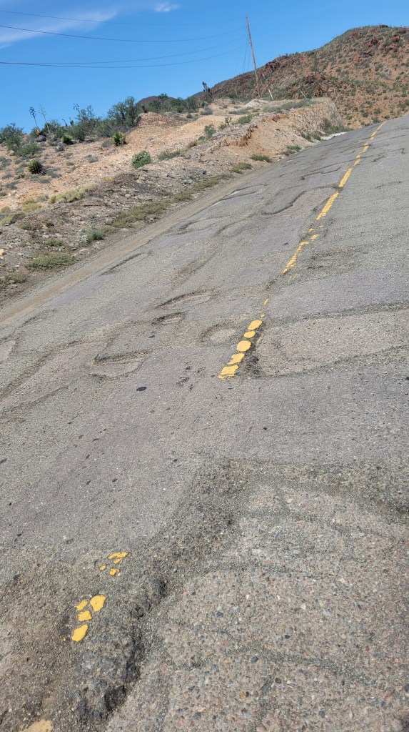

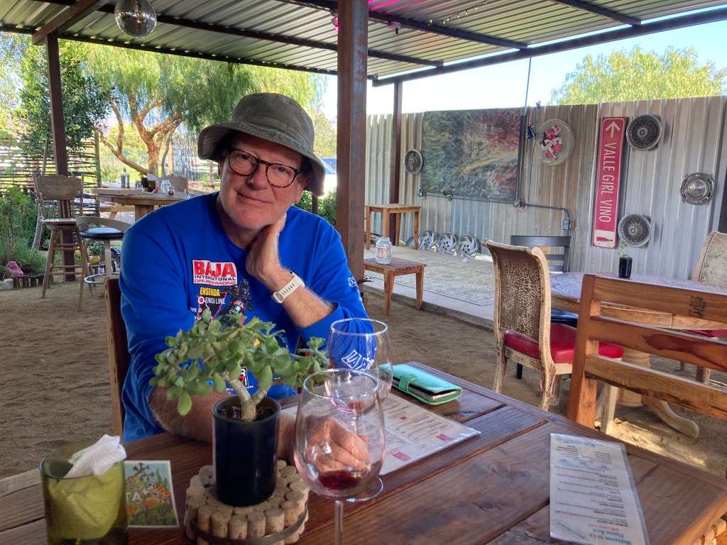
A bypass skirts the city and reroutes north towards the Tecate Border. It is along this stretch that encompasses most of Mexico’s wine industry. We had heard the road had some potholes and they were right. Google said it would be about a 6-hour drive and it was closer to 8 nail biting hours of whackamole road navigation. We had reserved at a winery called Valle Girl Vino with a female winemaker who we found out was a snake charmer in her past. Interesting since her wedding wine had an arty snake label.

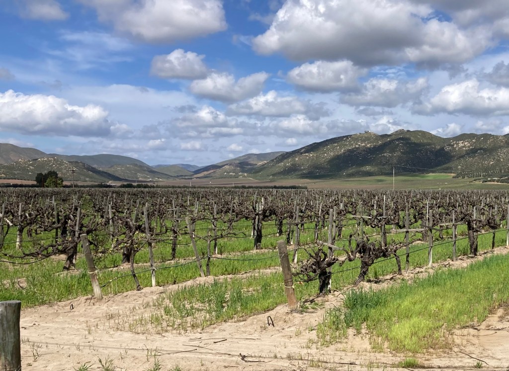
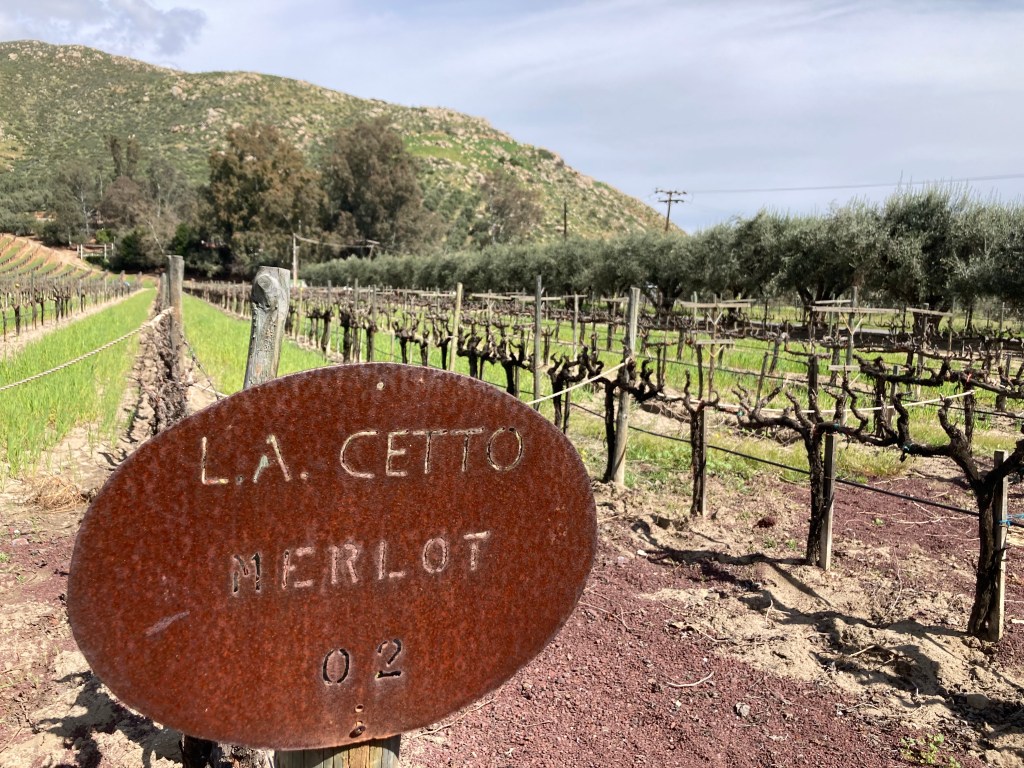
We did a tasting and stayed the night. Sitarra, the owner, explained the history of wine in the valley. Old French Colombard grapes grown by Russian settlers from the beginning of the 20thcentury were still being harvested for some of her offerings. The region is in the mountains with the ocean nearby. This is not a cold climate, but the wines did not have the raisin effect of grapes grown in excessive heat producing a very “cooked fruit” characteristic. These wines have balance and pleasant complexity considering the climatic challenges the grower/ winemaker has to deal with. Being winter the grapes were just coming out of dormancy and starting to show buds. Most vineyards had shade cloth secured along the wiry vine trellising for protection against the intense summer heat.
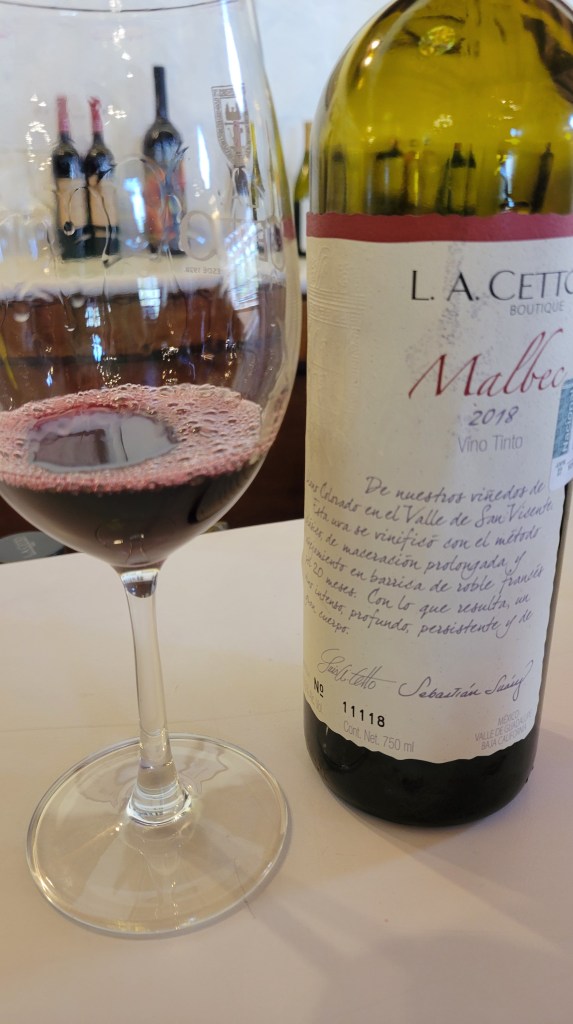
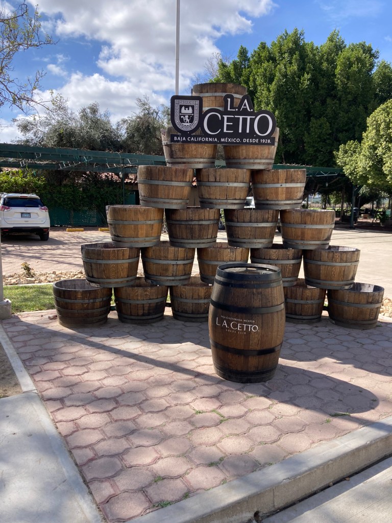
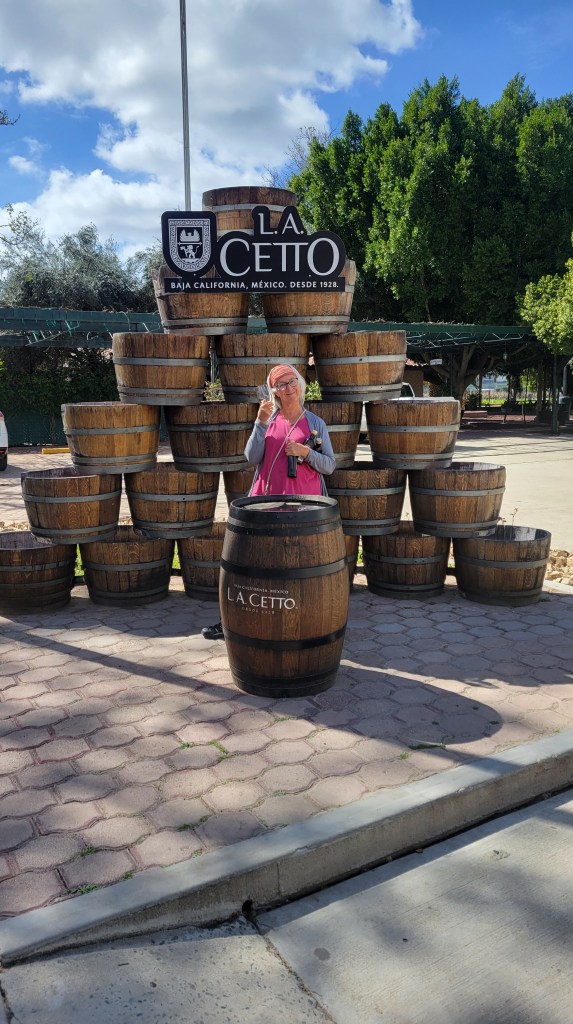
Arriving on a Sunday the roads were busy with tourists and locals enjoying a day off. There had been a rainstorm which made the bad roads terribly worse. We planned to find a campground to overnight so we could see some more of the area. Many were closed on Monday!!! But not Cetto, Mexico’s largest winery and the maker of our go-to wines over the last 5 months. Cetto’s ancestry started with Italian settlers and has been in business since 1928. With over 3000 acres of grape, they produce 16 million bottles annually divided over ten different quality levels. We knew their delicious “young wines” due to their affordability, so we decided to taste their boutique premium offerings. Our favorite was a complex Pinot Noir offering that was multi layered in complexities. Now that surprised us! Most of the vineyards that we saw throughout the region had olive trees along their fence lines, driveways and there were more than a few olive groves. We bought some Cetto olive oil.


And so ends our first foray into Mexico and our amazing trip through the Baja. We have seen a lot; the people are kind, drivers are courteous, and finding necessities of where to stay, clean water, food, fuel, etc were so much easier than expected. We will be back. There is so much more to explore!! And we haven’t even touched mainland Mexico.
Tomorrow, we head to the Tecate border located between Tijuana and Mexicali. We will head to our beloved Anza Borrego Desert State Park for a week or so and specifically the Blair Valley, Culp Valley and possibly Coyote Canyon as there are some places that may be in a super bloom phase at the moment.
See you soon!!
