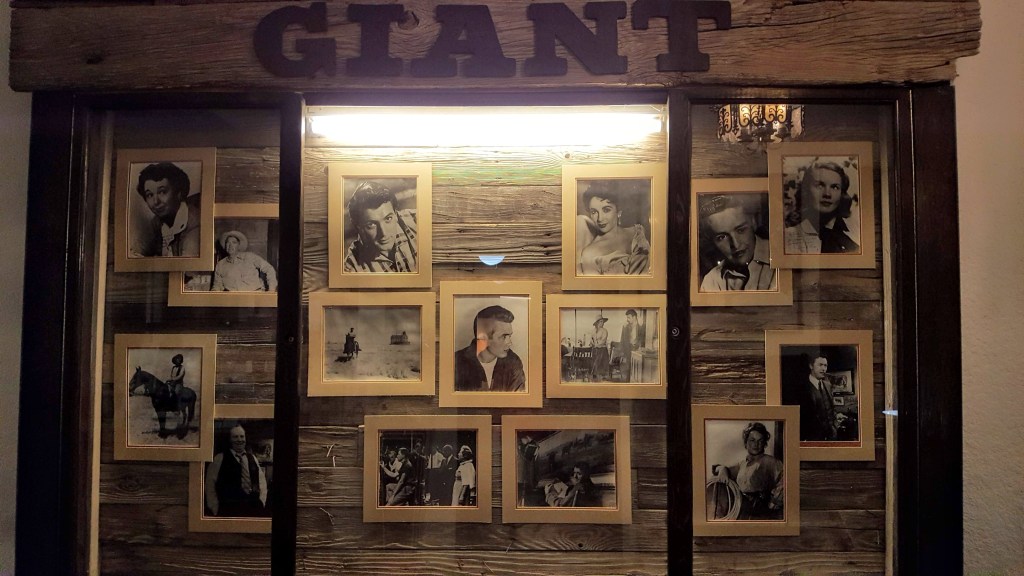
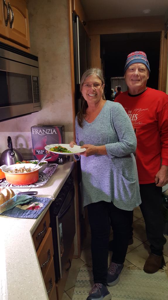
Albert and I grew up in the 70’s and 80’s. We were musically inspired by the bands that encompassed the end of the sixties as well. When we were planning the inevitable turn to go west, Albert mentioned that a stop in Jacksonville would be good because that is where the Lynyrd Skynyrd band was from. “Who?”, I asked. Anyway, I was kind of having him on and we ended up not stopping. Well now we were in New Orleans, heading for Austin and it would just be a bit north along the Louisiana/Mississippi border… “If we could just stop at the site where the plane carrying the Lynyrd Skynyrd band met its demise. There is a memorial to the band. We are here, it would be great to visit.” I kept having flashbacks to years before, the time we were really close to the James Dean crash site in California, and we couldn’t find it after driving back and forth and all around for hours. Now we were on the road, working with an old GPS with maps from 2012 and a different method of adding GPS coordinates. The Google on my iPhone had us driving off road. What to do. We went. We drove to the iPhone Google site. Fortunately, there was a road. Nothing. We drove towards the uploaded GPS coordinates, but it was in a totally different direction than the iPhone Google and in a different town. Then we looked it up on Albert’s Samsung and (angels singing) we found it!! We drove back, turned a few times, passed monolithic poultry barns, row by row, lined up for miles. Hundreds of thousands of chickens getting ready to be a happy hour wing or KFC special. The air was thick with the smell of mass farming and an economy for the few whose farms were the location of the mega company who paid them to grow these birds. As we arrived down very quiet backwoods, swampy Mississippi backroads we nervously pulled up to a cleared area along a dirt road. Three large marble slabs were erected, a wheelchair friendly path surrounded them and a guest book at a small table. There was one other car there when we arrived. Three people were sitting near the table and they greeted us.

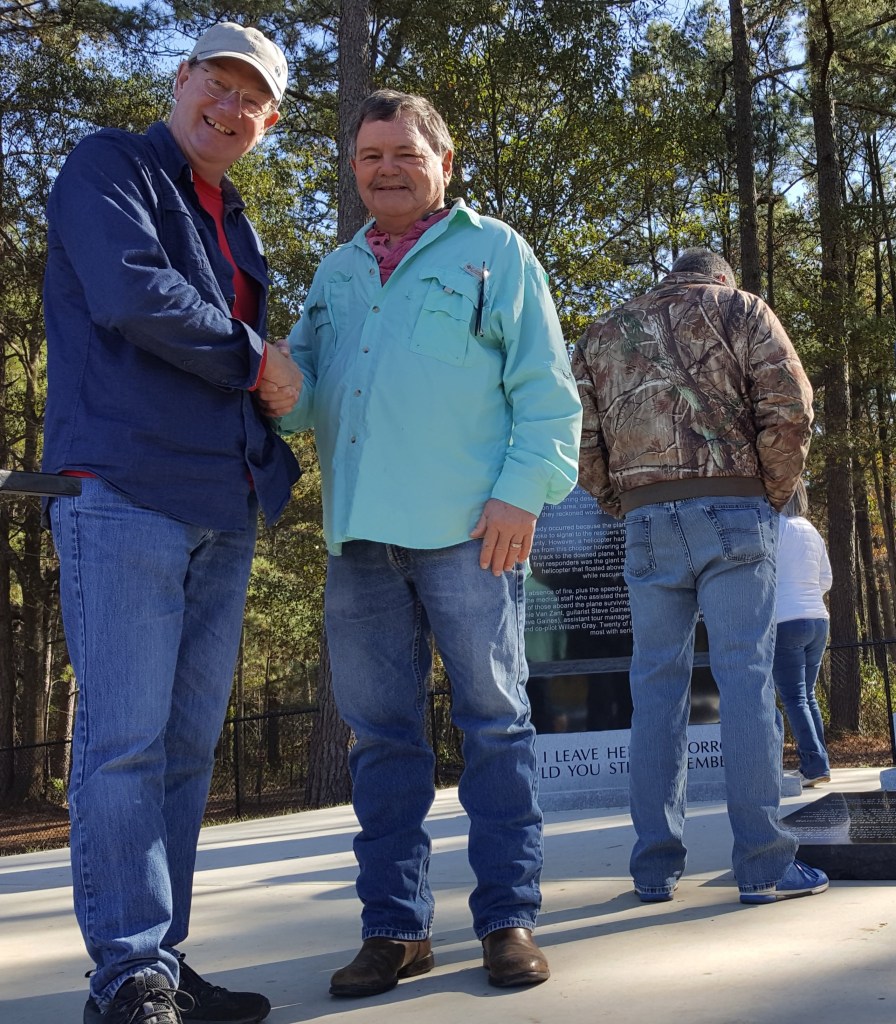


More cars arrived. More people came to see this memorial. And then we met Bobby McDaniel. He was there the day the plane went down and helped with the evacuation. When we left, we were part of a group of people who took the time to learn more of the story. Albert’s recollections of the visit to Gillsberg are as follows…
Bobby was in his early twenties on Oct. 20/77 and like most of his neighbors they were getting ready to have dinner and relax after a day of working around the quiet family farms in Gillsberg MS. The tranquility was suddenly broken around 7 PM by a loud noise and shaking throughout the neighborhood causing residents to look around for the source of the unusual disturbance. A ½ block away a private twin engine plane transporting the Lynyrd Skynyrd band had crashed into a treed section of a neighbor’s field forever changing the course of history for the remaining band members, the people of Gillsberg, and devoted Skynyrd fans around the world.
The flight started in Greenville NC. after a performance promoting the recent release of their 5th LP – “Street Survivors” (eventually going Double Platinum). The pilots aborted the flight to Baton Rouge LA. (approximately 900 miles) over Gillsberg due to lack of fuel. They attempted to ditch the flight in an open, marshy area of a field but over-shot it by about 1000 feet. The trees that it struck tore the craft open spilling everything along the way. It must have been a horrific sight when the local community (including Bobby) rallied together at the crash site providing triage to 20 injured, but fortunate, survivors and shrouded the 6 deceased in the fading autumn light. In the intervening years since that fateful event the town went about its day to day living – farming, raising families and healing their emotional scars from the traumatic events of Oct. 20/77. After 42 years of reminders from inquisitive, heart broken Skynyrd fans and international journalistic researchers into “the place” and circumstances where the Skynyrd plane went down, they formed a committee raising money for a memorial site dedicated to the remembrance of that fateful night.
Deb and I found the Lynyrd Skynyrd / Gillsberg memorial on Nov. 16/19. While we were there Bobby, and family, had coincidently decided to drive over. Seeing some visitors, he and his family graciously greeted individuals elaborating on details of the historic event and the town’s motivations for creating the memorial. During our brief conversation I felt he was unburdening himself and the community by relating their side of the story, providing a friendly and welcoming atmosphere and giving everyone some closure. If you decide to visit, I hope you are fortunate enough to meet Bobby, or any of the well-meaning folks that have given a public space to a tragic event.
There is a gofundme site called Lynyrd Skynyrd Crash Site Monument set up to raise money for the long-term maintenance of the memorial. If you feel so inclined to make a small contribution you will be assisting a group that hopes this space will be around for future curious generations. We are official Lynyrd Skynyrd Memorial donors.
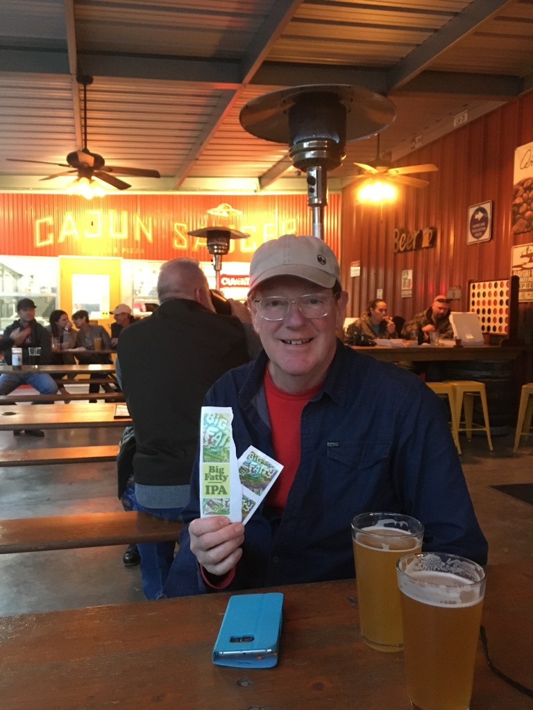
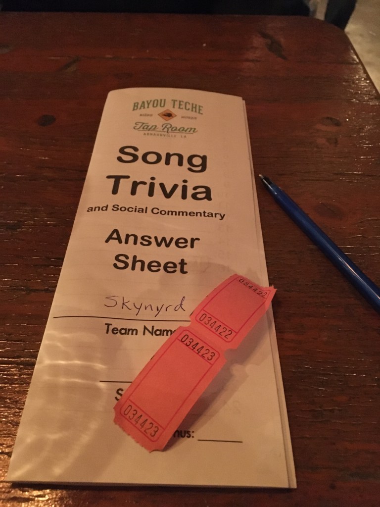
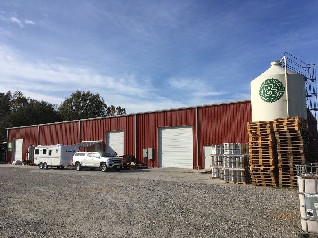
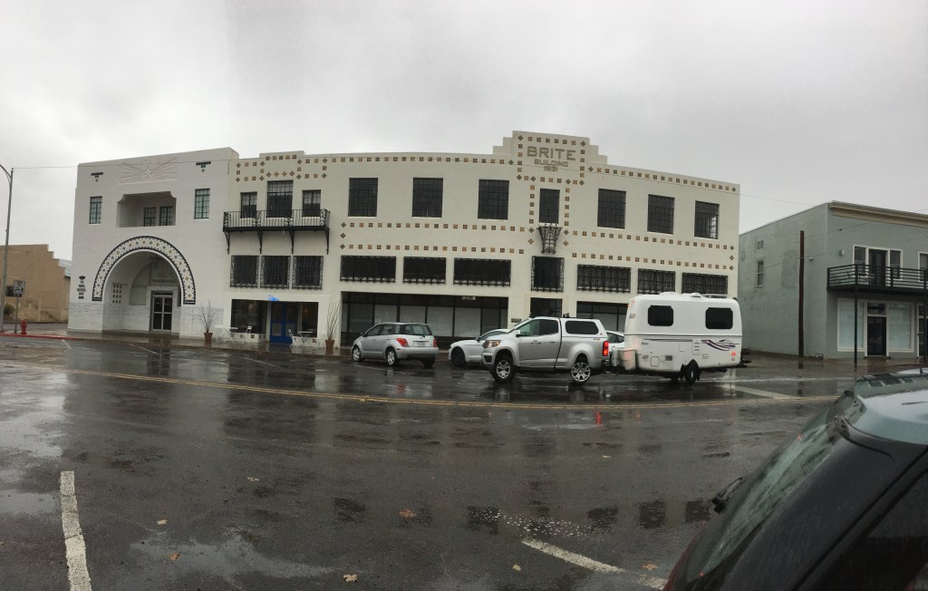
Enroute to Austin, we had decided to stay at another Harvest Host location in Lafayette. (pronounced La-fee-ett) On the way there we drove back into Louisiana and across a lake. As we drove the thousands of miles of causeways above the swamps, bayous and waterways, we had never seen trees that had such different trunks. We were too slow to take a picture and missed it. We decided to return on our way out the next day. On the outskirts of Lafayette is a neighbourhood called Bayou Teche. Our Harvest Host was the Bayou Teche Brewing Company. We arrived at about 4 on Saturday and the Cajun Zydeco band was on their last set. Oh well. We heard a bit and felt pretty lucky to arrive at that moment. Then the DJ (possibly the brewery owner) started playing music and songs by request. We bought 2 beer, ordered a pizza from the wood fired pizza business that accompanies the brewery and settled in. The DJ was giving away free beer for so many random reasons including looking happy or driving a green car. There was so much beer being compted one of the other guests were leaving so they gave us a beer ticket. When Albert went in for another round (one with a ticket), I quickly asked the music man to play a Lynyrd Skynyrd song when Albert came back out. As soon as Al came back, Sweet Home Alabama began blaring. Al asked if I had asked him to play it. What? Is that Lynyrd Skynyrd? So, he went to talk to the DJ and tell him about our day. Later, that resulted in two free beer tickets “Because we are Skynyrd fans”. (Third round) The night just got better. Music trivia was about to start. Twenty songs and you only need to write down the name of the group or singer. It was free to play. Rules-NO PHONES!! OK. After about 10 songs the DJ announced the prizes. Top prize was 4 tickets for McGee’s Louisiana Swamp & Airboat Tour. Every song was sponsored by a local business and there were many prizes. Then the DJ announced that for every correct song you would win a beer. We didn’t win the airboat tour but we won 8 beer and knew which company would get our business the next day on a swamp tour. When we collected the beer, they threw in another 4. WOW!! We drank about 6 beer, over the course of 6 hours so we were pretty sober, but we laughed so much and sang alot so it felt more festive.
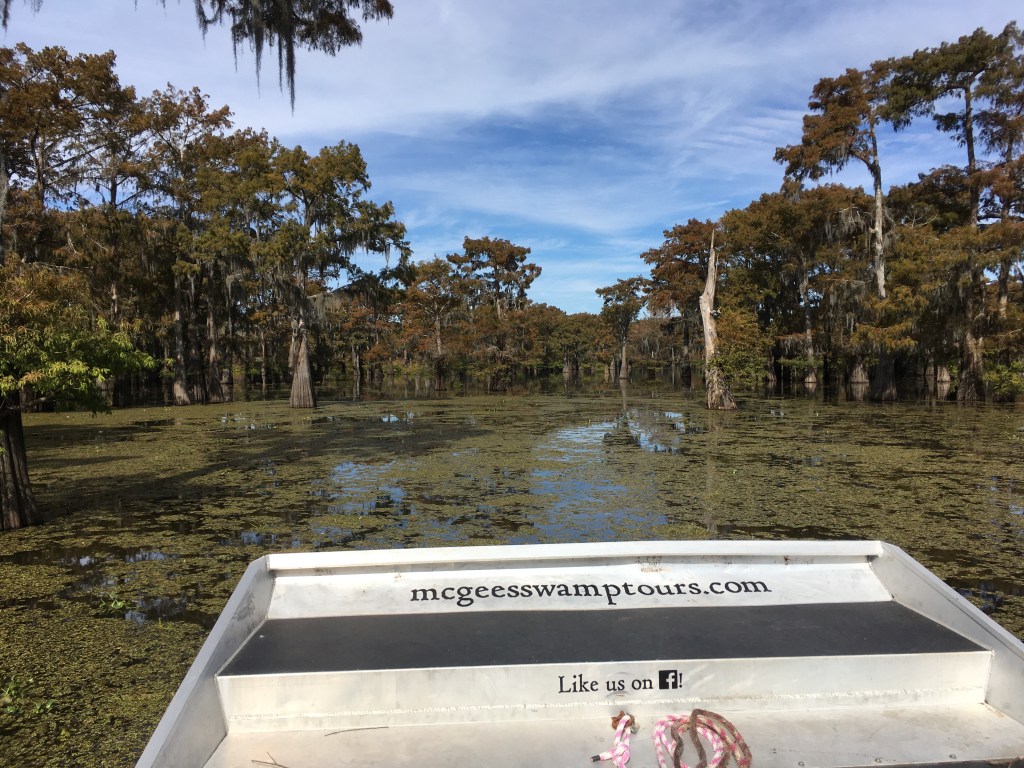
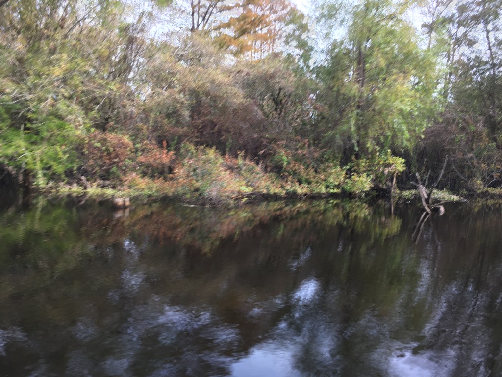
McGee’s swamp tours needs a minimum of 4 people to go on a swamp tour and fortunately two others had booked that morning for the same tour we wanted. As often happens, the GPS and google don’t have the right address for the location, so panicked, we called the company and explained we would be a bit late. We were traveling down a one lane dirt road on the side of a levy that contained the water in the Atchafalaya Basin and towing a trailer we needed to figure out a way to turn around. We did, they waited, and off we went! WOW. Turns out this lake was the lake we had driven over the day before. The bayou that is the Atchafalaya Basin is the largest swamp of its kind in North America. Prehistorically it was what is now the Mississippi River. We learned so much. The trees were cypress that have genetically evolved to grow in water. The alligators will not bother you if you paddle the bayou, unless you have a dog, they like to munch on dogs. The snakes are more of a worry if they fall out of a tree into your boat. The water is only 2 feet deep and in the dry season it is grassy, where during a hurricane or wet season the water will rise another 6 feet. It all depends on weather upstream. Our tour guide couldn’t actually talk to us when the boat was running. The engine was too loud. We had ear protection and were bundled for a chilly morning on the water. He said we may not see any gators because they hibernate in the cold. But Albert saw a small one slither off a log into the water when we came around a bend and we did see one in the water. She was far enough away that we could not see her body but we did see her eyes and nostrils above the water. Not photo worthy. But that’s ok. The trees were the best part for me. That boat ride and the information about the industries associated with the bayou was fascinating. Fishing, crayfish, oil, tourism and more were all part of this watery mass that was life in the swamp. Fascinating. We were starting to find more interesting things to see, but the clock was ticking and we were aching to get to the desert. After our airboat tour we headed to Texas.


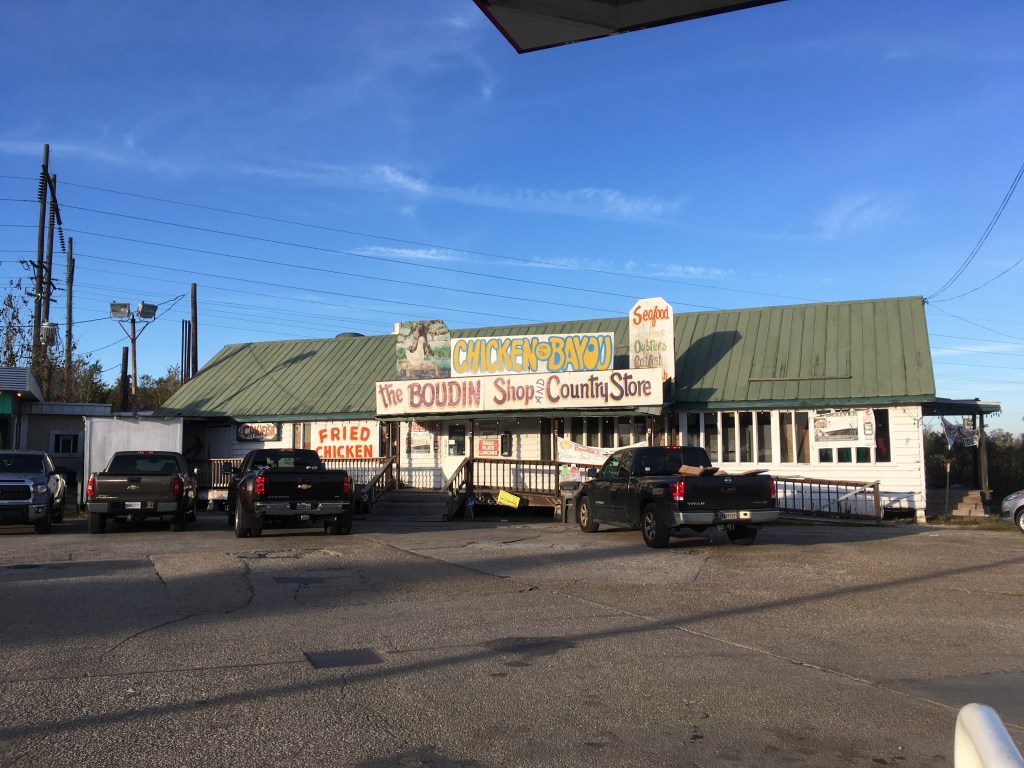
Austin was too far away in the time we had and we decided on another Harvest Host just outside of Houston in Anahuac. When we left the boat tour we knew we needed to refuel and had seen a station near the turn off to Bayou Teche where we had stayed the night before. We decided to stop there because there was a shop beside the gas station that sold gulf prawns and boudin, a rice sausage that had added flavours such as meat, crayfish, or alligator. We fueled up, bought prawns, crayfish boudin, and another local delicacy from the freezer that was a soft yeast bun with a prawn and crayfish filling. Me -“Can you bake these? The instructions say to bake them on a high heat. How do you like cooking them?” The clerk – “Y’all should fry ‘em. Or they dry.” Me – “Ok, we’ll try them.” Meh. They weren’t great. Mushy inside with fishy taste.
The next part of our trip had the cheapest gas. At one point we were gassing up for about $0.75CAD/litre. We did the math. It was no wonder. Every town we passed had some sort of oil refinery. It was depressing knowing that we needed the oil for everything we do and especially right now, living the life we are living. As we got closer to Houston, it was definitely evident that we were getting into oil country. It was about to get bigger once we got into the heart of Southern Texas, but that is later… About 10 miles south of the I-10 is a large bay, Trinity Bay, that is off the larger Galveston Bay. The GPS also had a built-in altimeter and it was reading 45 feet below sea level. How is that possible? Levis? As we drove, we were on part of the thousand of miles of above-water bridges that are the highways through the bayous and swamps that define the southeast corner of North America. We called the Frascone vineyard to reserve and he said he was on the side of a Texas Bayou in the small community of Oak Island. So off we went to see what a Texas bayou looked like. When we arrived, we met Mr. Frascone.
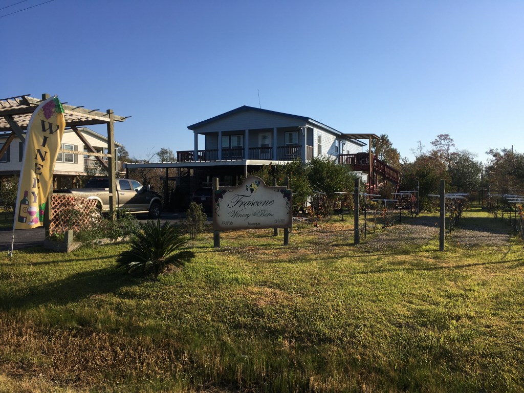

Retired and probably the happiest man on earth. One of those people that you meet who has lost absolutely everything and has rebuilt from nothing. He was at the end of a road surrounded by houses on stilts, including his own. He owned most of what we saw. He had a few vines beside his house and his ground level basement was a commercial kitchen and a small wine making facility. In 2008, Hurricane Ike had completely destroyed everything in Oak Island. His home was uninsured. So he had packed up his RV and left for a couple of years and when he returned he was a recipient of one of 14 new homes that were donated by singer Neil Diamond. Over time he had rebuilt his vineyard. He had other vineyards throughout Southern Texas where he grew varietals with different climates. He claimed he was one of the earliest registered vineyards in Texas. When we arrived, he was working on a shelter that would become a wedding venue and his next thing was to put in about 6 RV pads with water and power. His resilience was infectious. He was genuinely excited that we would detour off the I-10 to find his place as a free accommodation. They aren’t really free if you buy their wares. But he didn’t care if we bought or stayed 3 nights, since we would certainly tell stories of our time there and that was enough. We bought wine, olive oil produced by a neighbour, and honey harvested from his bees. He also made Meade…. really sweet. Not our thing….

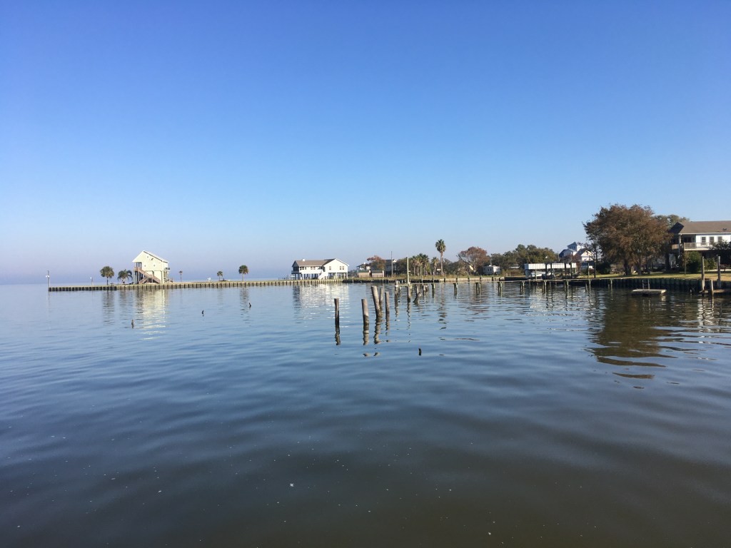
We wandered down to the shoreline and looked at his neighbourhood. All the houses were built at least 10 feet above the ground. Again, we were amazed at the human condition, eeking out an existence in such hazardous regions. Of course, these southern Americans probably thought the same of Canadians. So darn cold.
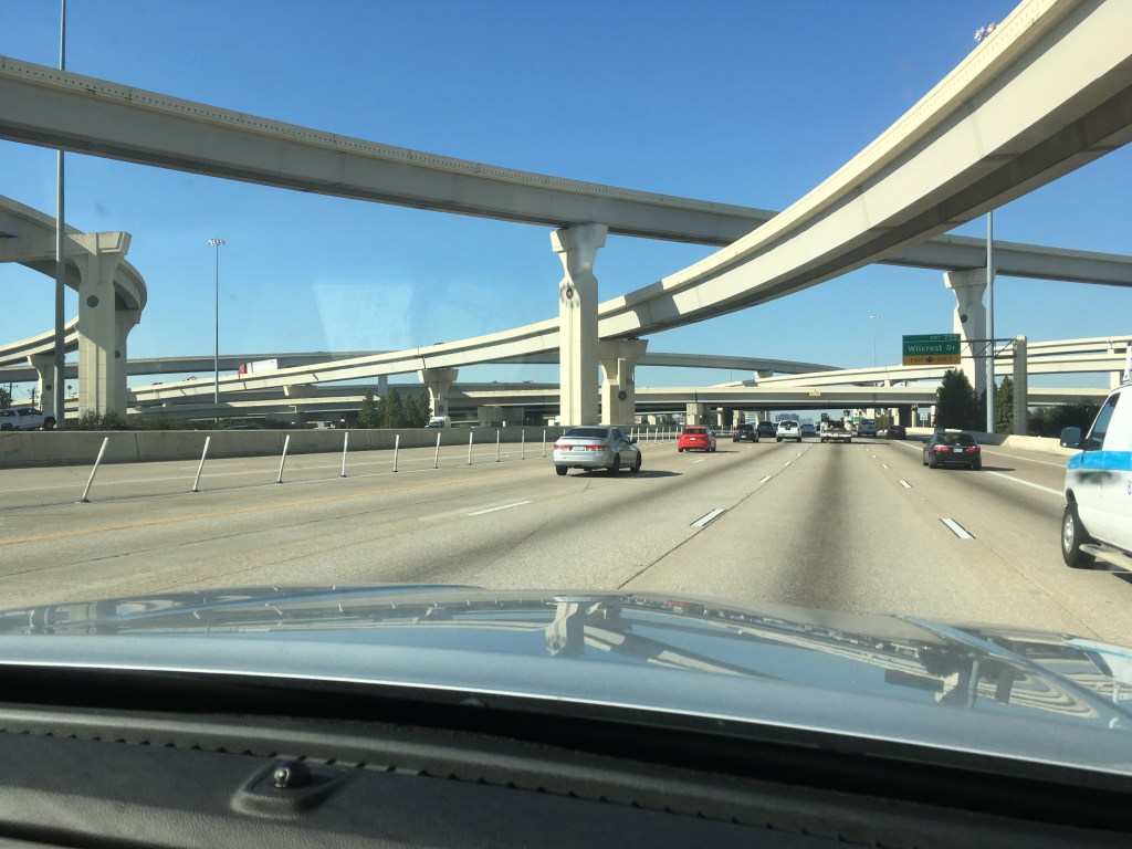
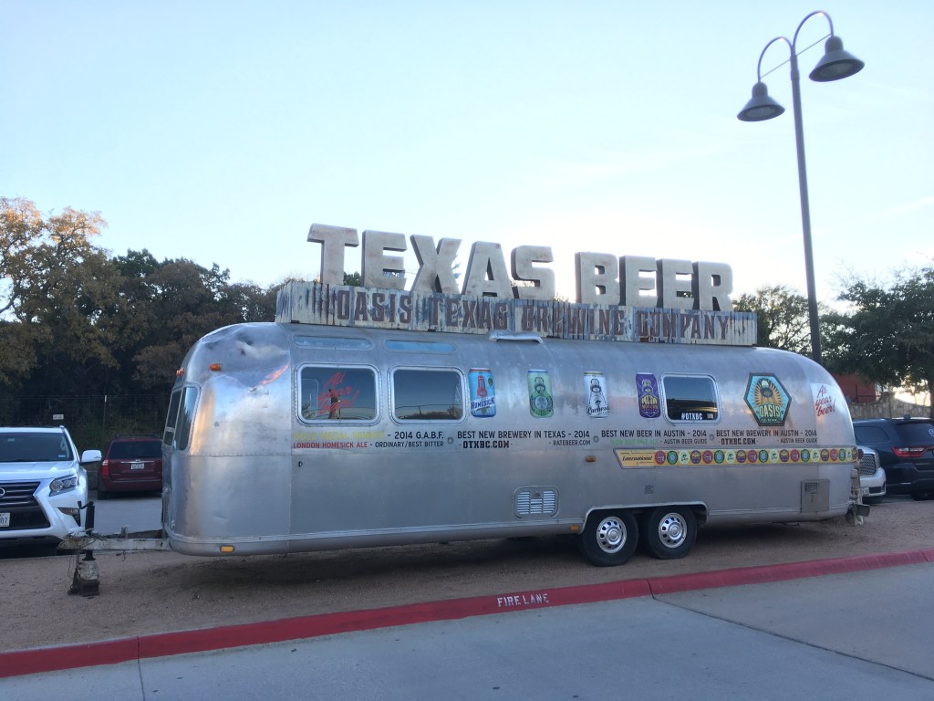
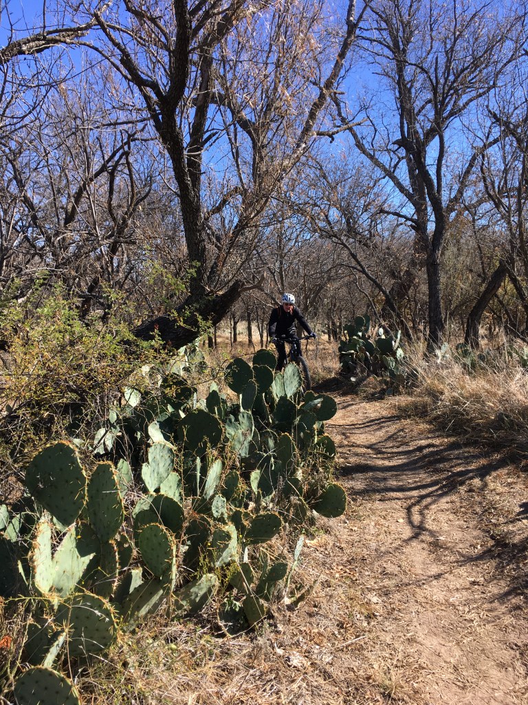
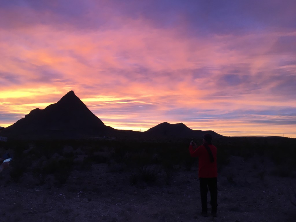
Next day we headed for Austin looking for music and Texas BBQ. We camped by the lake at a regional park for the first couple of nights and then wanted to move in closer. Texas cities were all about building more highways and parkades to increase the number of cars on the road. The traffic was shit. Our beloved I-10 had 9 lanes going each way through both Houston and Austin with at least 6 highways overpassing above. Crazy traffic. When we were in the regional park, we found some nice loops of cross-country mountain biking just down one of the highways about 15 minutes from our campground. And we rode through prickly pear cactus groves. We were officially getting closer to the desert. Austin is in a transitional zone between the arid dry southwest and the humid wet southeast. After biking we headed for a beer at the Oasis brewery. Situated high above Lake Travis, another dammed off piece of the Texas Colorado river, facing west, it was a perfect place to also enjoy the sunset. Plus, the beer was delicious!!


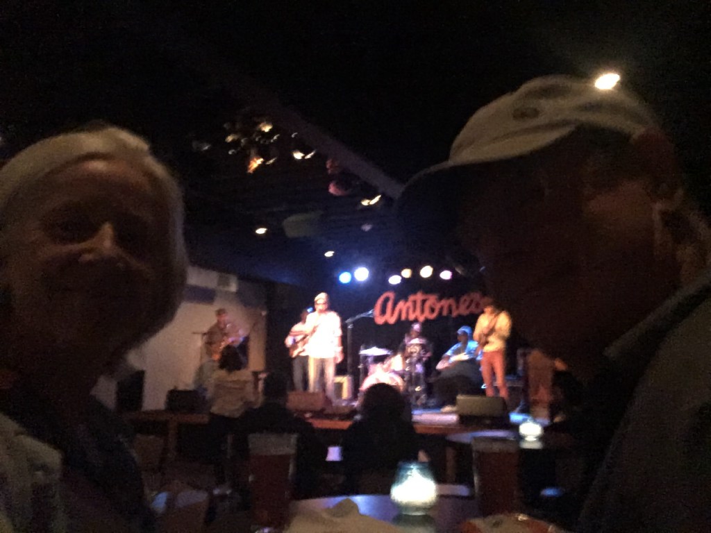
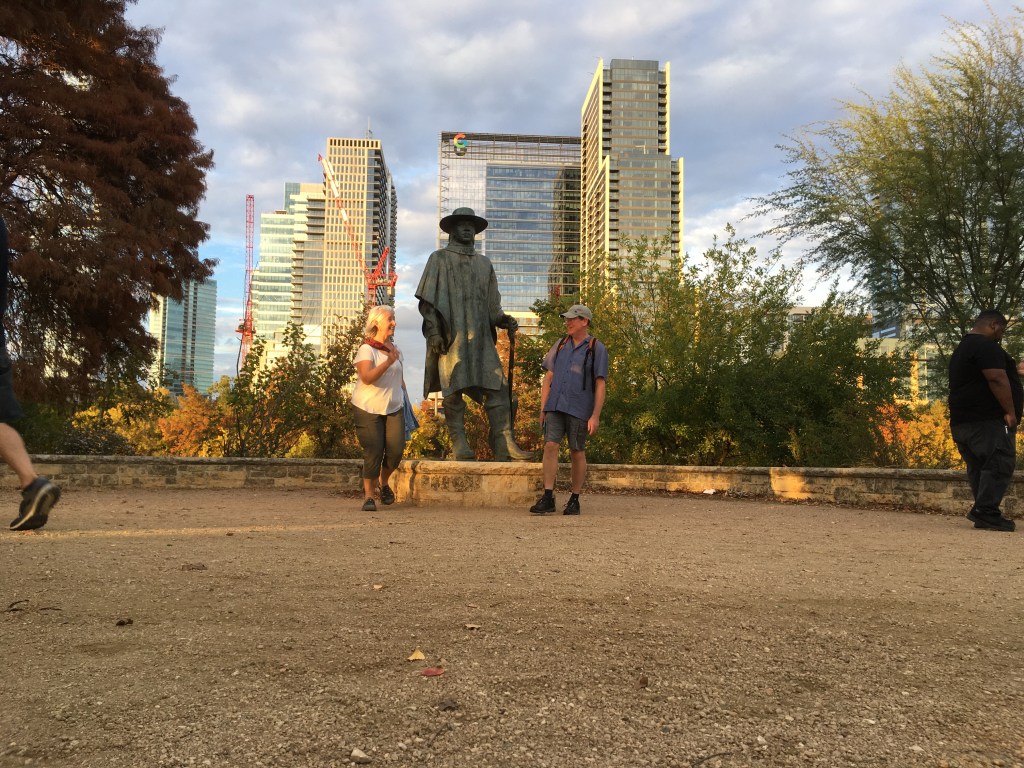
We moved closer to town to an RV campground just south of downtown and commuted with Uber. We hit the tourist info office and then walked by the many defining landmarks that make Austin. We took pictures of ourselves with Willie Nelson, Stevie Ray Vaughn, Leslie Cochran, the Austin City Limits, Angelina Eberly, the Driskell Hotel and the red granite Texas state capital building (larger than the US capitol building…its Texas…Everything is BIG)…That night we fit in a live music show at the iconic Antone’s. An Uber back to the trailer and next day we drove into town. We pulled our bikes out and rode the 20-mile bike way that winds its way around both sides of the Lady Bird Lake, the dammed river reservoir that winds through the city. Fall was in its full splendor and the temperature was perfect. The trail-way was amazing, with cantilevered bridges over the river when a hill slope was too sharp. It was excellent. And it made us hungry for Texas BBQ.


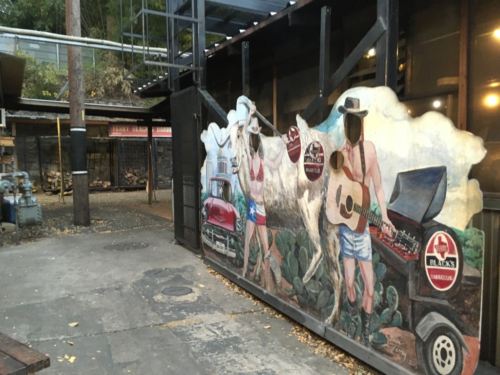
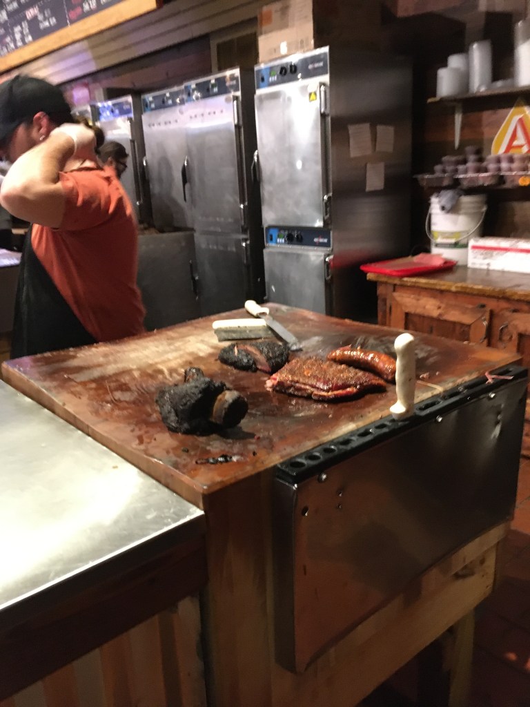
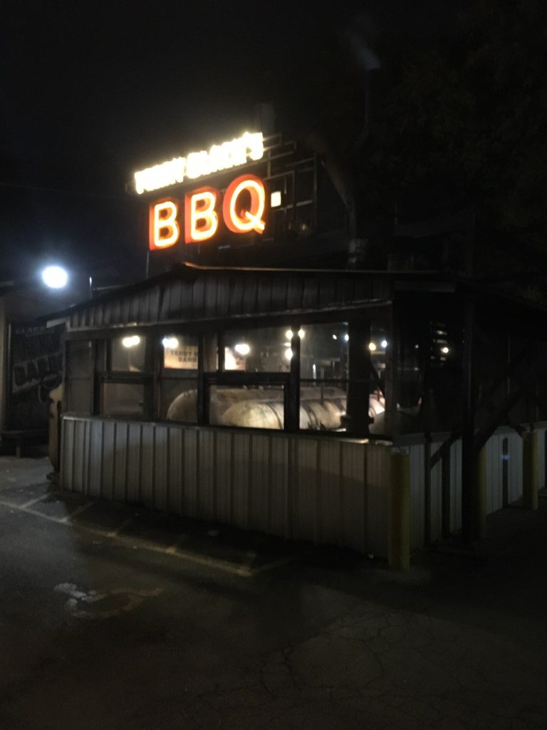
There are two renowned BBQ places in Austin. One involves a day long line up and no guarantee the dish you want will still be available when you finally get to order. The other one is Terry Black’s BBQ. Great BBQ, Texas style and a system that makes sure they can accommodate all the customers that visit. No huge lineup but booming busy. We quietly parked, perused the BBQ pit, then went indoors.
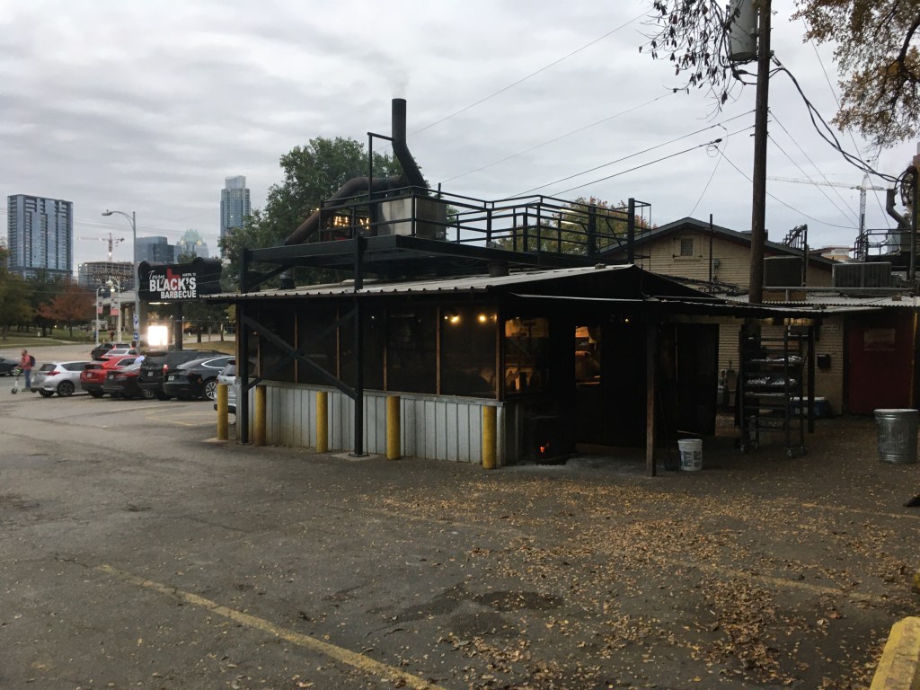


The lineup runs past a self-serve beverage icebox, then you order your sides and they hit your tray, then the meat. Three BBQ carving stations so when one is done, go to the next. Like a Walmart cashier line. We got to the carving station and the cook explained the products. He ooohed and ahhhhed about the beef rib that was juicy. So, we ordered one. All the reviews had said, “have the beef rib”. He said it was about a pound or so and sold by weight. Mostly bone, lots of fat and a tiny bit of juicy meat. One beef rib like fatty brisket with a bone, one sausage link, 4 oz lean brisket, 4 small perfect pork back ribs, and 4 side-dishes. All was served up on a paper lined plastic tray. Turns out the beef rib, mostly bone, was about $35US/lb and by the time we had the rest and the sides plus 2 cans of beer it was over $85US.

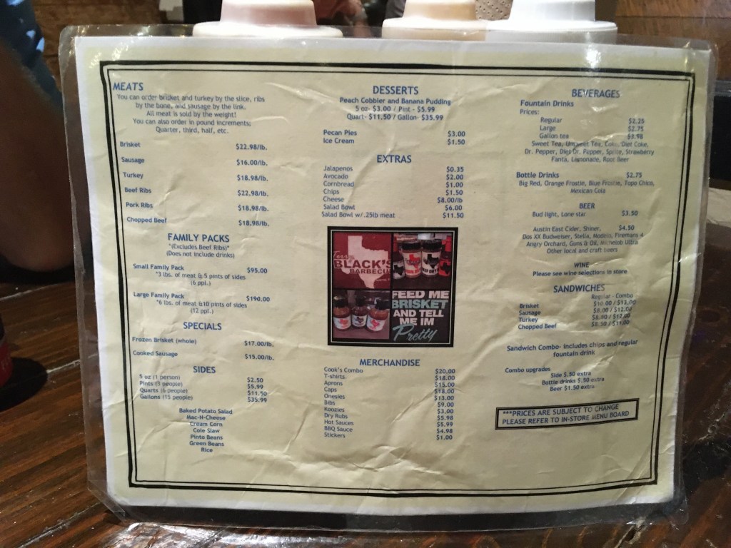

How do people afford this?!?! It was good and our BBQ needs had been more than met. But that was the budget blown right to hell! Austin was a nice city with a great vibe that felt safe and fun. We were done with the city vibe and were ready to get out.
Our method of choosing the next direction and ultimate destination was to find some biking and camping. We decided to go to San Angelo State Park in Texas. San Angelo is not a state park we would have known about except that it was situated in the direction we wanted to go, and it had over 50 miles of mountain-bike trails. We arrived at the gate and the ranger sent us out to our campsite in the horse camp.


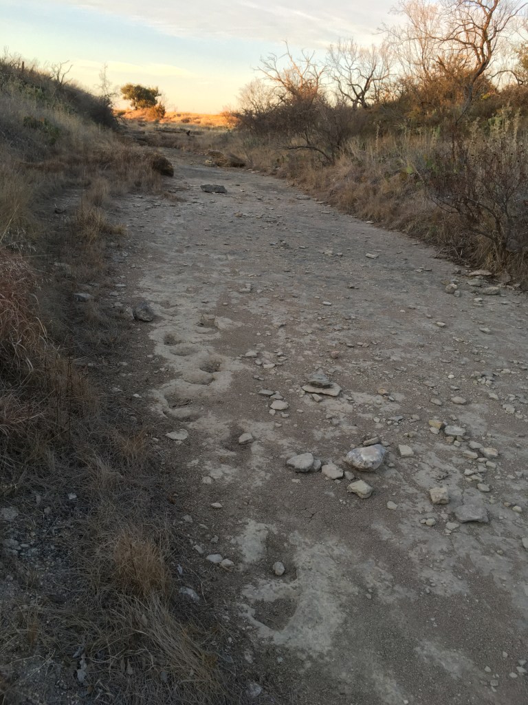
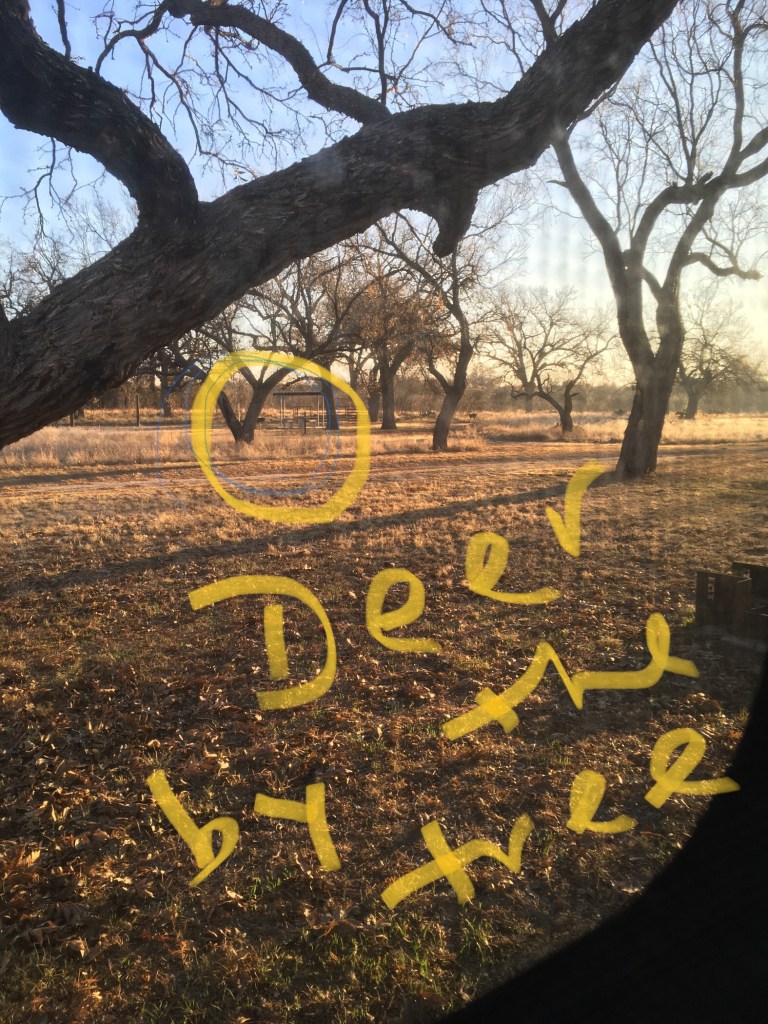
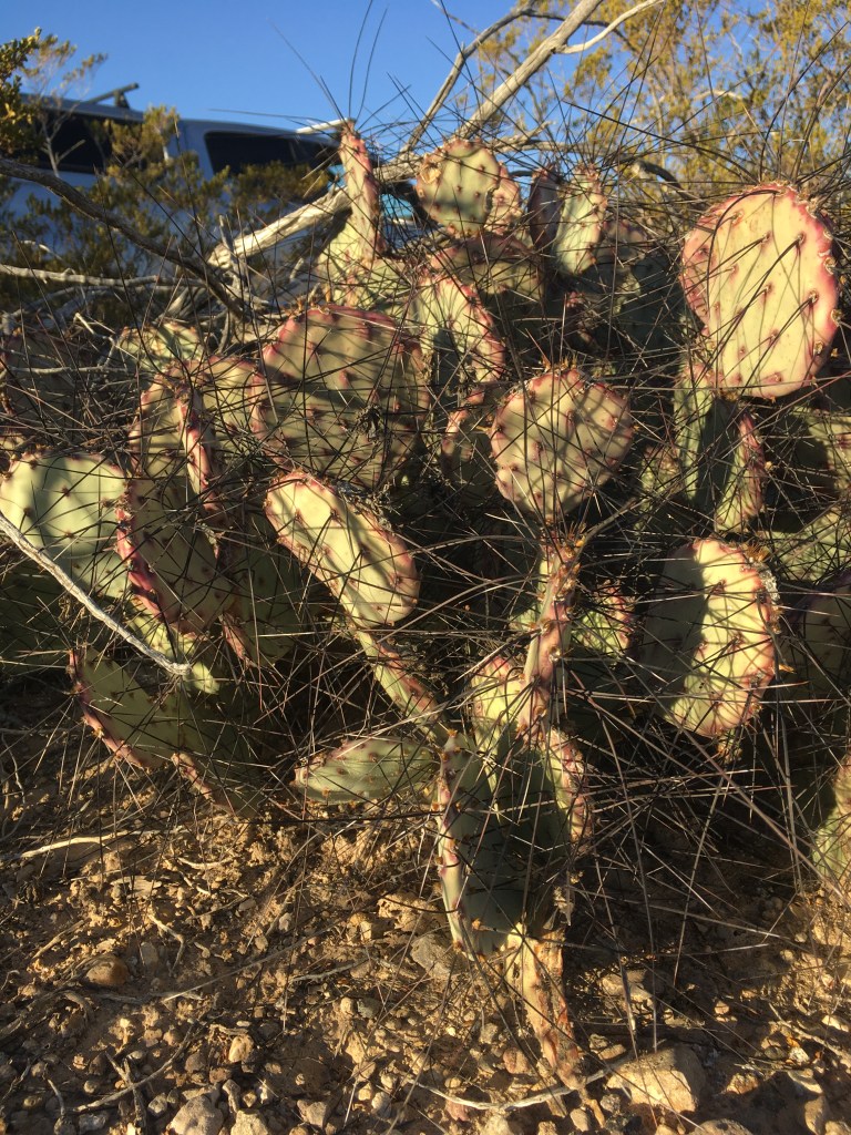
We had to unlock a gate to get in there. We were the only campers. No horses. But power and water hook up for just $15 per night. When we arrived, I got out of the car and walked towards the site and a fully camouflaged fawn emerged out of the grass and ran away. It was surreal. We set up, got our bikes out and headed out on to “Dinosaur Trail”. Yep, dinosaurs were there before us. Amongst the Chihuahua desert cacti, grasses, deer and wash (that’s desert lingo for stream bed) were footprint impressions of a pre-dinosaur creature in what was mud during the Permian Age. Dusk was approaching and the whitetail deer were moving. At one point one shot across our path. We were lucky we weren’t hit. Its strides were at least 35 feet and it was moving at lightspeed.
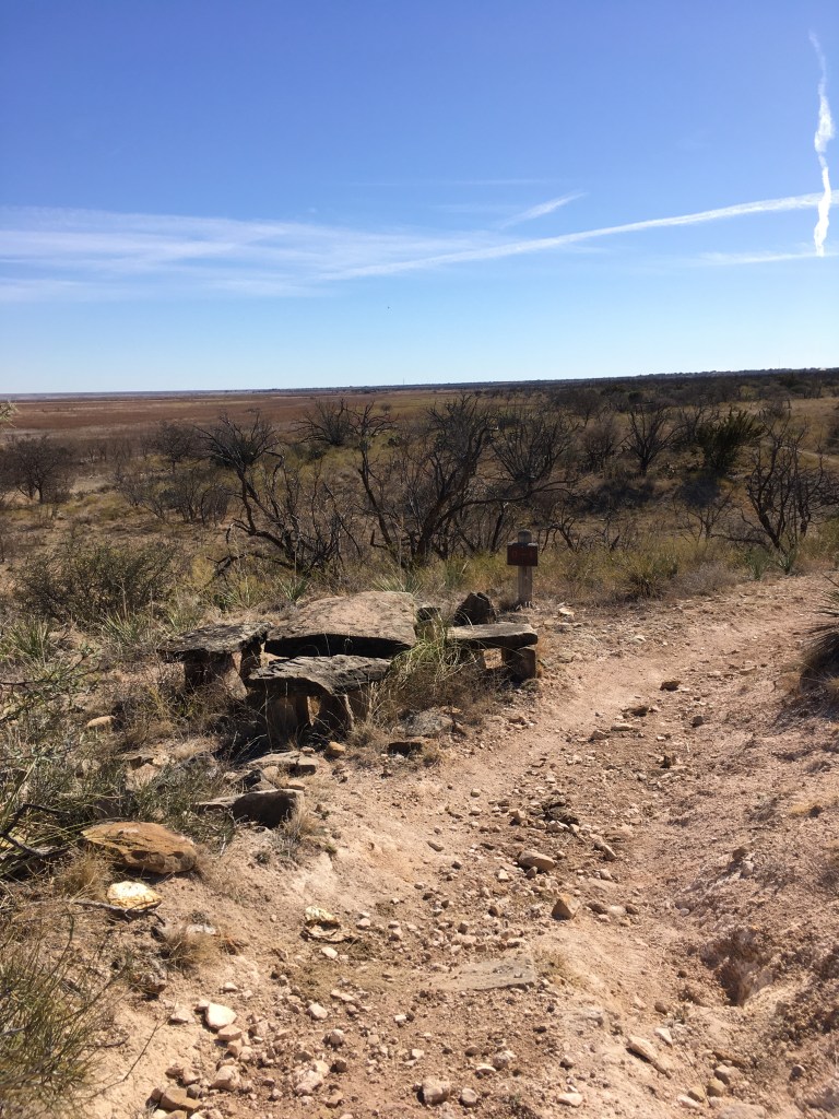
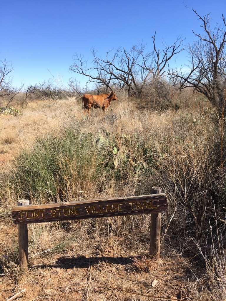
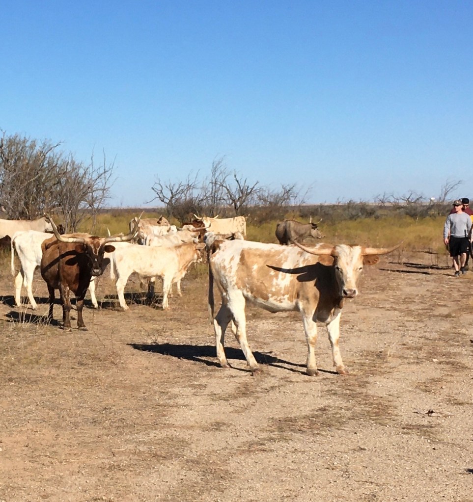
Next day we rode all over that park. The trails were mostly easy cross country with some challenging bits which made the day spectacular. We found a dry lake and dry creek beds, old campgrounds and overgrown roads leading to them from the days when boomer families flocked to these parks, long horn cattle, wild turkeys, rocky drops, and the Flintstone trail with a rock table and chairs. With so many miles logged traveling seated in the truck, our 40 km ride felt like we had finished a marathon. The benefit of a trailer over a tent. A fridge. A cold beer. Yum.


Our ultimate directional goal was to go to the Carlsbad Caverns National Monument in New Mexico and after 3 nights in the open wilderness of San Angelo, we headed out. Carlsbad is located on the northeastern fringe of the Chihuahua desert. This was an interesting drive because we were now fully on the Permian basin where oil bubbles to the surface and the old seabed is rich with fossils and fossil fuels. Traveling along this highway to Carlsbad was one oil refinery and fire stack after another.

Halfway from San Angelo we stopped in the oil-bubbling metropolis of Midland to refuel the truck and asked about filling with water since our plan was to dry camp at a BLM site just outside of the Carlsbad Caverns. The happy staffer at the gas station said we would have to buy water. Everyone does. They do. There was no potable water there. Then we noticed that all the trucks going by were water trucks. Tanker after tanker, bringing potable water to oil camps, businesses, houses, and retail water sites along the highway. We ended up driving into Carlsbad to refuel and the next friendly staffer at the gas station said we could fill with their water. Fully potable. We took the risk and are still alive so perhaps it was ok water. We were buying drinking water anyway.


Carlsbad Caverns were a highlight. In order to access the caves, we drove up through a desert valley to the top of the ridge overlooking the oilfields of Permian Basin. The mountain ranges surrounding the basin formed a horseshoe shape over the thousands of square miles of oil rich land stretching through New Mexico and Texas. From the Carlsbad Caverns visitor center there was a milelong trail that descended 850 feet of elevation into the cave. Once at the base, where the elevator drops visitors, another walkway through the cavern looped through the “Big Room” for 1½ miles along a paved path winding through spectacular cave decorations with LED lighting staged by theatre professionals. Stalacmites, stalactites, draperies, soda straws and water pools with flowery lily pad formations presented themselves after tens of thousands of years of sulfuric acid carving and gypsum deposits followed by dripping water. Depending on the amount of water that would fall in the desert that year gave the cave its “life” to “grow” its decorations.
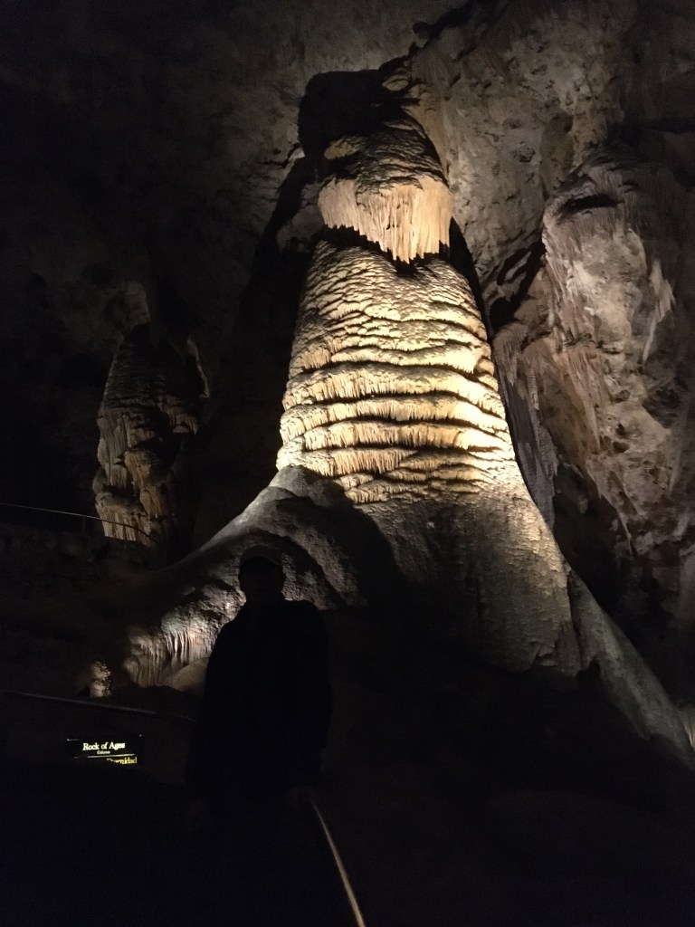


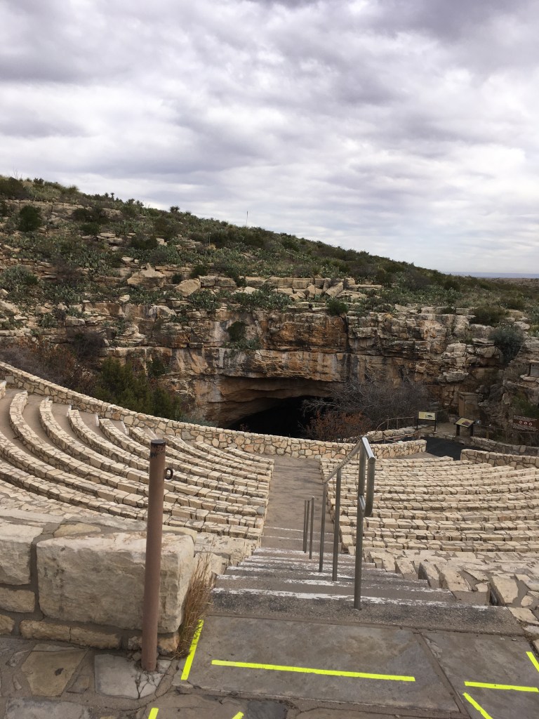
The last ice age grew a lot of these decorations. A drip of water hitting you while walking was called a “kiss” and it may have taken 30+ years to drop. We took the elevator to the surface and returned the next day for a tour of another locked cave. The entrance to the caves had a huge amphitheatre built for people to watch the bats when they exit the cave at dusk or re-enter at dawn. Bats are a feature in the area and in Austin, as they fight for their existence worldwide. The bridges in Austin also featured bat awareness and were built to house bats. With the threat of white nose fungus hitting the world bat populations, huge efforts to educate and ameliorate the disease are in play. Entering the cave, the rangers check if patrons had been in any other caves and if so, they were to sanitize their shoes in special baths as if going into a science lab or animal farm operation. We saw no bats as they had retreated to Mexico for the winter.

We met some lovely people, Donn and Judy, from Colorado at the BLM campground and shared some similar stories. They, like us, were “full timers” living in their rig and had no formal plans so we headed along to Big Bend National Park together. The highway south was along the eastern side of the Guadelupe Mountain range and climbed over a pass then down to the next part of the desert. We were driving during a cold snap with freezing rain and cold. We were glad it was a driving day. We poked into Marfa, a very cute artsy community, then overnighted in Alpine just down the road. Next day it was American Thanksgiving and the busiest park weekend of the year with no campsites booked, none available, and not sure where we would stay. Big Bend is just that, a park where the Rio Grande turns a couple of corners defining the southern Texas map. The land was full of mining, farming along the river, trade between countries, agriculture and a cross cultural population before it became a border and ultimately a park, and it still showed evidence of its history. Big Bend has plenty of excellent hiking and even a rowboat crossing where you can go to Mexico for a pricy taco at Boquillas. We arrived knowing we wouldn’t have camping, so the ranger suggested we call local RV businesses outside the park. We did. No one answered and no one called back after leaving a message.


The park office had cell coverage, so I looked up RV camping on the Campendium website and found a place called “Biker Haven”. I called. It rang. A voice loudly and gruffly answered, “HELLO!” I said I found his number on Campendium and did he have room for a Class A Rig with a vehicle in tow and a truck with 21 ft trailer in tow. “Yup, no problem. No hookups but plenty of space.” He proceeded to give directions as the GPS and Google coordinates on the website were wrong. He said to call when we arrived, and he would come down and get us registered. Trusting the universe, we proceeded 18 miles north to a road called Terlingua Springs Ranch Road, “lots of mailboxes”, then 11.2 miles east. No service on that road for about 11 miles. Worry. Then the signs. “BIKER HAVEN NEXT RIGHT” Shortly after we saw a tell-tale yellow rattle snake flag that said, “Don’t Tread on Me”. We pulled in and shortly after that a sassy dune-roll-bar-type quad showed up with a rifle in the visor. Yikes. Texas. Ron was courteous and friendly; told us “we weren’t camping but joining a club”. In order to join the club, we had to sign some paperwork with the rules of the club and pay our membership. $15. The rules were mostly about being respectfully quiet during sleeping hours, putting trash in the cans provided and no open fires due to the chance of a brush fire. Now the difference was that the very first rule was “NEVER CALL THE LAW”. Ha!!!
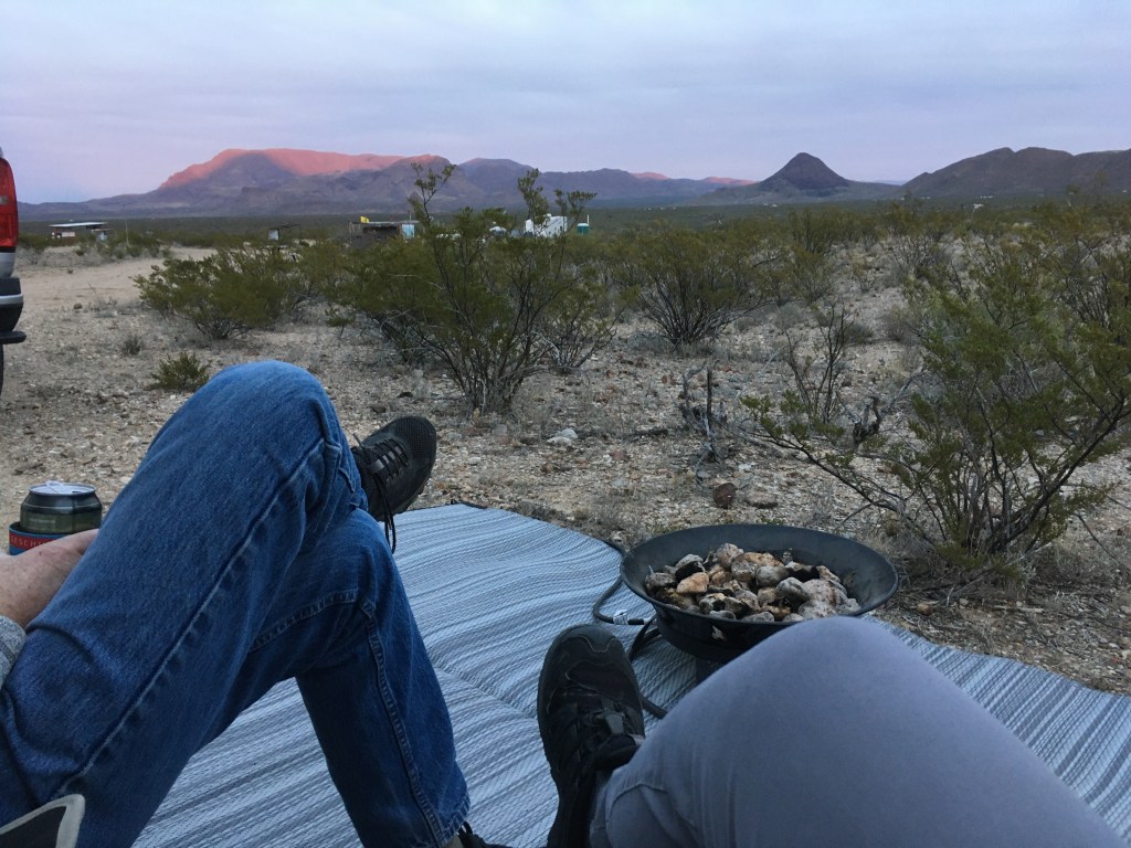
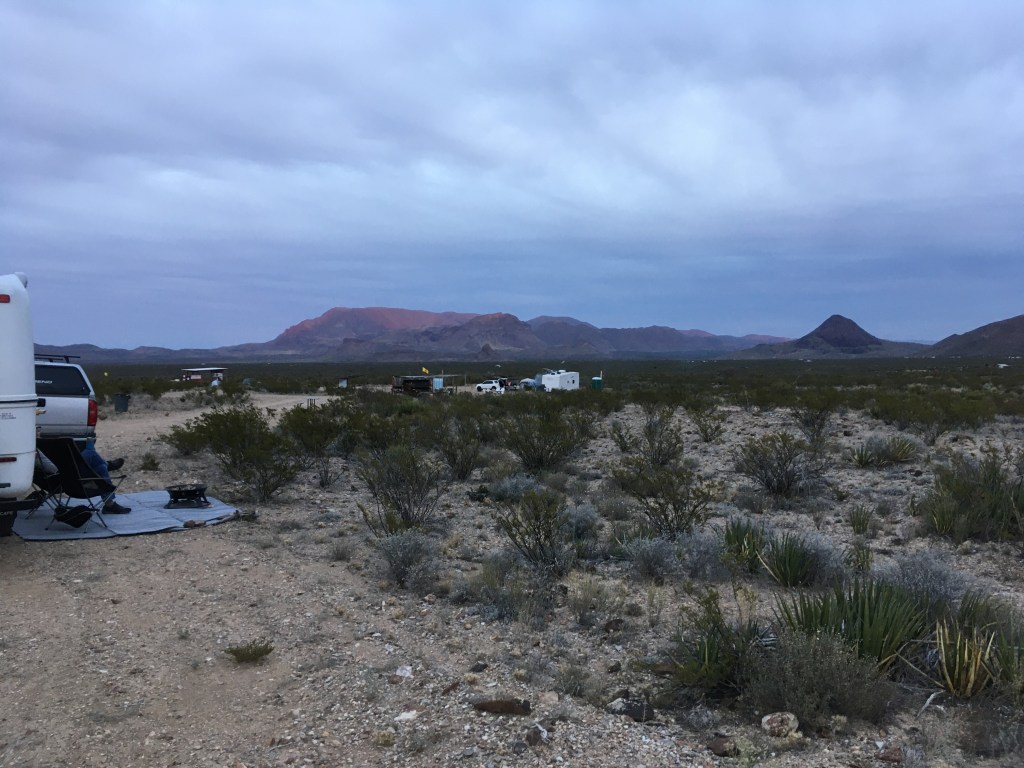


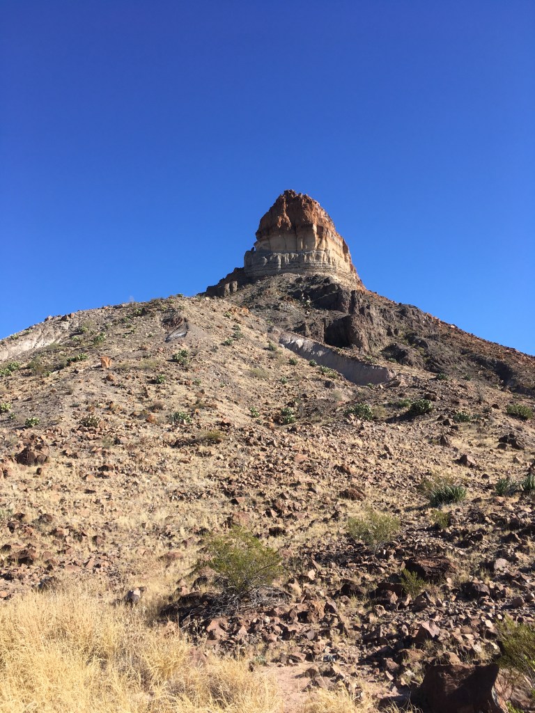
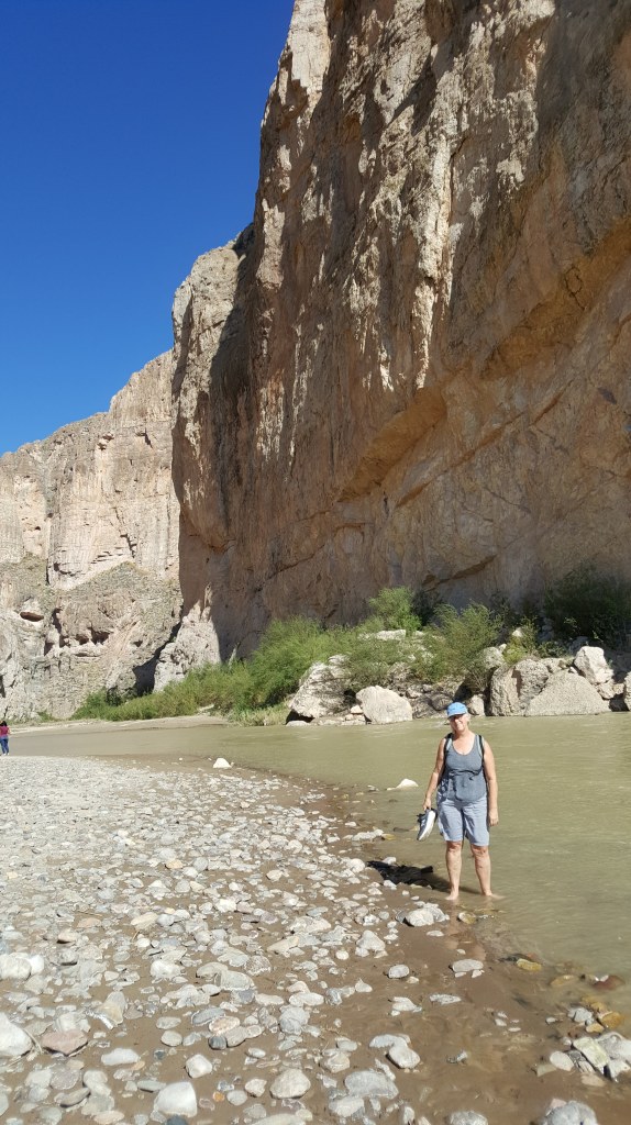
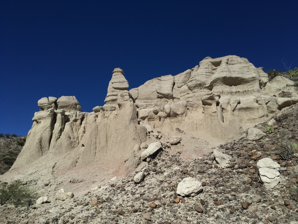
It was super safe, we never called the law, it was quiet and beautiful on the open savannah with leafless Ocotillo, Creosote bushes, Cholla and the ancient volcano cones surrounding the valley. We stayed 3 nights including a traditional Thanksgiving dinner with Donn and Judy. We hiked The Window trail, Boquillas Canyon trail, and drove some of the 4×4 roads that took us to old settlements along the river and in the hills. When we arrived at Boquillas crossing, we noticed a truck rolling big fat 4×4 tires off the cliff edge to the narrow river. We also noticed people in the river rolling the tires to the other side and loading them into a truck on the Mexican side. Ha! Import-export business!!


It was time to move on, do laundry, Christmas baking and shower, so we booked into a fancy expensive RV park west of Big Bend National Park at Lajitas. Donn and Judy kept going. We stayed 2 nights and explored the mountain biking in the area and in Big Bend State Park.


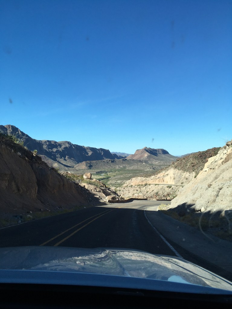
We left Lajitas and decided to follow the scenic Texas Mountain Trail route back towards the I-10. We wound up driving over big hills and valleys in Big Bend State Park and Fort Davis State Park and up to the University of Texas McDonald Observatory. About 10 k down the road was a picnic area called Madera Canyon, that allowed overnight parking. We set up amongst the Ponderosa Pines and Alligator Junipers, ate, and went back for the “Star Party”. Bundled in our warm winter duds we and hundreds of others experienced the stories that the astronomers told of the constellations. No Big Dipper at this time of year in southern Texas. We hadn’t seen our easiest identified constellation for months. Afterwards, the telescopes were focussed on supernovas, lunar craters, and other galaxies. Next morning, I was out for a jog before we left and saw a herd of Javelinas. Cool!!


Our destination was Las Cruces and the White Sands National Monument in New Mexico. We were leaving Texas.
